Danakil Desert
Situated in the Afar Triangle, it stretches across 136,956 square kilometres (52,879 sq mi)[citation needed] of arid terrain.
Local geology is characterized by volcanic and tectonic activity, various climate cycles, and discontinuous erosion.
The basic geological structure of this area was caused by the movement of tectonic plates as Africa moved away from Asia.
[5] Other areas of the Danakil became sinks, dry endorheic basins as precipitation evaporates faster than it can collect in permanent lakes.
The area is flanked toward the east by the Danakil Alps, a tabular mountain system that has a few volcanic cones which peak in height in Mount Ramlo (2,130 metres (6,990 ft)).
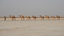
While the water is gone, salt remains in extraordinarily large quantities, and has proven to be a valuable — and fatal — commodity for locals.
In the past, salt was used as a form of currency in the region, but now the miners use regular cash to conduct transactions.