Daniel Boone National Forest
It is home to a range of plant and animal species, although many areas still bear evidence of industrial logging and other practices which took place mostly prior to federal protection.
[4]: III-2 Due to shallow soil, heavy rains may result in severe local flooding, and conversely, many tributaries may become completely dry during periods of little rainfall.
[c] Around 1760, Daniel Boone reached an understanding with Richard Henderson for the exploration and preparation of the wilderness beyond the Appalachian Mountains, so that it may be more easily settled by those who sought to move westward.
[10]: 33–4, 37–8 On March 17, 1775, the Transylvania Colony, founded by Henderson, and for which Boone was employed, reached an agreement (over the objections of the governors of Virginia and North Carolina) with a grand counsel of the Cherokee Nation to purchase all land from the Kentucky River to the Cumberland River, including large part of modern-day Kentucky and Tennessee, an area known as the Transylvania Purchase.
As part of the Forest Service's examination of the area, E. Murray Bruner published in 1914 an extensive report covering 900,000 acres (360,000 ha) of land in Kentucky, and concluded in part: Because of the general rugged topography of this section and very great influence it exerts upon navigation of the Kentucky River, it is very essential that its protection from extensive clearing be assured.
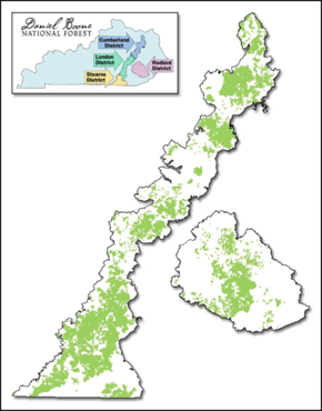
[10]: 210 By the time the area was officially declared the Cumberland National Forest in 1937, the tract spanned 409,567 acres (165,746 ha) of federally owned land across 16 Kentucky counties.
[10]: 206 However, it was not until 1966, following, among other things, a resolution to the United States Department of Agriculture by the Kentucky Senate, that the name was officially changed by Lyndon B. Johnson to Daniel Boone National Forest on April 11.
[4]: S-8 As of 1985, when the forest service published their environmental evaluation of the area, about 92% of the land was considered "tentatively suitable" for the production of timber.
[4]: III-19 Notable animals that inhabit this forest frequently seen by visitors include black bear, coyote, bobcat, white-tailed deer, wild turkey, gray squirrel, muskrat, quail, opossum, ruffed grouse, rabbit, red and gray fox species, raccoon and mourning dove.
[12]: 3–241, 3–243 Within the forest's boundaries lie three state managed parks, Buckhorn Lake, Cumberland Falls, and Natural Bridge.
There is one designated National Recreation Area, the Big South Fork, located in the southwest corner of the forest,[4]: III-2 and one National Recreation Trail, the Sheltowee Trace, which stretches almost 290 miles (470 km) from northern Kentucky to Pickett CCC Memorial State Park near Jamestown, Tennessee.
[12]: 3–242 The Pioneer Weapons Wildlife Management Area, representing 7,610 acres (3,080 ha) near Cave Run Lake, was created as a partnership between Kentucky Department of Fish and Wildlife Resources and the US Forest Service, and is an area where hunters are permitted to use only comparatively primitive weapons, such muzzleloaders, bow and arrow, or crossbows.