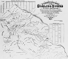
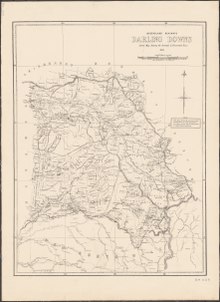
Darling Downs
The Darling Downs is a farming region on the western slopes of the Great Dividing Range in southern Queensland, Australia.
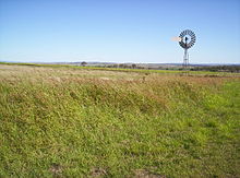
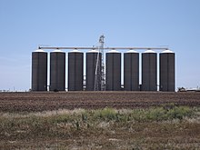
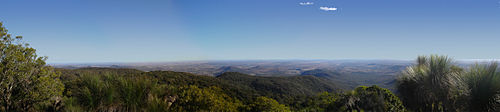
The landscape is dominated by rolling hills covered by pastures of many different species, vegetables, legumes such as soy beans and chick peas, and other crops including cotton, wheat, barley and sorghum.
Between the farmlands there are long stretches of crisscrossing roads, bushy ridges, winding creeks and herds of cattle.
Other typical sights include irrigation systems, windmills serving as water well pumps to get water from the Great Artesian Basin, light planes crop-dusting, rusty old woolsheds and other scattered remnants from a bygone era of early exploration and settlement.
[5] The largest city and commercial centre of the Darling Downs is Toowoomba[6] about 132 kilometres (82 mi) west of Brisbane.
Other towns situated on what is now called The Downs include Dalby, Warwick, Stanthorpe, Wallangarra, Goondiwindi, Oakey, Miles, Pittsworth, Allora, Clifton, Cecil Plains, Drayton, Millmerran, Nobby, and Chinchilla.
(This is different to the IBRA subregion also known as The Southern Downs Interim Biogeographic Regionalisation for Australia, which is further west, around the towns of Roma, Mitchell and Injune).
[8] Originally, the Darling Downs was covered with a wealth of indigenous grasses which created an ideal verdure for stock eight months of the year.
The Darling Downs Aboriginals had an annual burning season at the time when the indigenous grasses were ripe and dry.
In June 1827, Cunningham climbed to the top of Mount Dumaresque[10] (near what is now Clintonvale close to Maryvale) and after wrote in his diary that this lush area was ideal for settlement.
Cunningham returned to Moreton Bay in 1828 and with Charles Fraser charted the route through the pass to the Darling Downs.
[11] Ludwig Leichhardt in 1844 saw the remains of a camp showing the signs of white men through ridge poles and steel axes.
News of the lush pastures quickly spread resulting in a land grab that authorities in the distant New South Wales colony found difficult to stop.
Later the expansion of Queensland Rail's train networks and Cobb and Co's stagecoach transport greatly assisted access to the region.
[26] The lower temperatures of the milder summers in the Stanthorpe and Killarney regions allows farmers to grow lettuce, celery, brassicas and potato.
[22] A commonly grown grass species Panicum coloratum, also known as Bambatsi, is well-suited for pastures used for grazing because it is suitable to the heavy-cracking clay soils found in the area.
[30] Several other plants in the area were also closed leaving the remaining meat processor at Yangan in high demand.
[31] In 2014, the Oakey Abattoir which is the fourth largest meat processing plant in Australia,[32] launched an environmental initiative to extract green energy biogas from its waste water streams.
[33] In the Southern Downs region surrounding Stanthorpe in an area called the Granite Belt there are now over sixty cellar doors, wineries, and vineyards.
The Jondaryan Woolshed is a heritage-listed shearing shed situated at a site where a tourist operator has collected numerous related structures.
[34] The rich discoveries have lent weight to the theory that humans were not a factor in the extinction of the ancient megafauna species.
The New Acland Mine expansion, north of Oakey, has been delayed by the largest environmental public interest court cases in Australian history.