Lassen Peak
On May 22, 1915, a powerful explosive eruption at Lassen Peak devastated nearby areas, and spread volcanic ash as far as 280 mi (450 km) to the east.
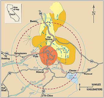
On July 23, 2012, a lightning strike started the Reading Fire 1 mi (1.6 km) to the northeast of the Paradise Meadow region, which was contained after it reached an area of 28,079 acres (113.63 km2).
[24] Other plants found in the Lassen Peak area consist of coyote mint, lupines, mule's ears, ferns,[25] corn lilies, red mountain heathers,[26] pinemat manzanitas,[27] greenleaf manzanitas, bush chinquapins,[23] catchflies, Fremont's butterweed, buckwheat, granite gilia, mountain pride, mariposa tulips, creambush,[28] and a variety of chaparral shrubs.
[29] In forested areas below 7,800 ft (2,400 m), animals include American black bears, mule deer, martens, brown creepers, mountain chickadees, white-headed woodpeckers, long-toed salamanders, and several bat species.
At higher elevations, Clark's nutcrackers, deer mice, and chipmunks can be found among mountain hemlock stands, and subalpine zones with sparse vegetation host populations of gray-crowned rosy finches, pikas, and golden-mantled ground squirrels.
Among scattered stands of pinemat manzanita, red fir, and lodgepole pine, animals include dark-eyed juncos, montane voles, and sagebrush lizards.
Meadows at the bottoms of valleys along streams and lakes support Pacific tree frogs, Western terrestrial garter snakes, common snipes, and mountain pocket gophers.
The region is also affected geologically by the Cascadia subduction zone, which dips eastward beneath the western coast of North America in the Pacific Northwest, as well as horizontal stretching to the east of crustal rock in the Basin and Range Province.
[9] In the southern segment of the Cascades, volcanoes exhibit widespread and long-lived activity produced by magma that ranges from low-silica basalt to siliceous (silica-rich) rhyolite.
[35] The Lassen volcanic center is fed by two magma chambers, one calc-alkaline reservoir common to the rest of the Cascade Volcanoes, and the other a smaller volume of low-potassium olivine tholeiitic basalt associated with the Basin and Range province.
[35] Volcanism within the Lassen vicinity follows a trend of intermittent, episodic eruptions punctuating long periods of dormancy, a pattern which persisted through the late Pleistocene and Holocene.
[36] Around the same time, about 614,000 years ago, an explosive eruption southwest of Lassen Peak produced 20 cu mi (83 km3) of pumice and ash, covering the area between the vent and what is now the city of Ventura, California.
This deposit, referred to as the Rockland tephra, reaches up to several inches in thickness within the San Francisco Bay area, and can be found as far as northern Nevada and southern Idaho.
Following the end of volcanism at Brokeoff Volcano hydrothermal fluids began chemically weathering minerals in the andesite flows, altering the once strong rocks into easily eroded materials.
Glaciers and streams were able to rapidly erode deep channels into these altered volcanic rocks, reducing the once lofty peak of Brokeoff Volcano into the landscape we see today.
[43] By 18,000 years ago, Lassen Peak started to form a mound-shaped dacite lava dome, pushing its way through Tehama's former northern flank.
[54] In addition to the fact that cinder cones usually erupt lava from base vents,[55] there is a lack of physical evidence suggesting activity at the volcano since its formation in 1650.
[38][56] The areas surrounding Lassen Peak, especially to its east, south, and southeast, represented a meeting ground for Maidu, Yana, Yahi, and Atsugewi Native Americans.
[57] The first white man to reach Lassen Peak was Jedediah Smith, who passed through the area in 1821 as he made his way for the western coast of the United States.
The Twin Lakes sequence includes the construction of the Chaos Crag dome complex between 1100 and 1000 years ago and eruptions at Lassen Peak beginning in 1914.
[58] On May 30, 1914, despite an apparent lack of precursor earthquakes,[68] Lassen became volcanically active again after 27,000 years of dormancy, when it produced a steam explosion that carved out a small crater with a fairly deep lake[69] on the volcano's summit.
On May 20, the lower Hat Creek valley flooded with muddy water, which damaged ranch houses in the Old Station area and caused minor injuries among a few people, all of whom escaped.
In May 1917, an especially strong steam explosion formed the northern crater on Lassen Peak's summit,[73] with eruptions lasting two days and producing an ash cloud that extended 10,000 to 12,000 ft (3,000 to 3,700 m) into the sky.
"[43] Loomis's pictures were published in his book Pictorial History of the Lassen Volcano (1926); a number of his original plates remain in the archives of the National Park Service.
Their activity varies based on the season; during the spring, when meltwater is more abundant, fumaroles and pools of water have lower temperatures, while mudpots have more fluid mud supplies.
[82] Moreover, a number of the potentially active Californian volcanoes reside less than 100 mi (160 km) from highly populated areas,[84] and explosive eruptions could produce ash that travels for several hundred miles.
Due to the threat of an avalanche from nearby Chaos Crag if volcanic activity renewed in the area or an earthquake occurred, the Visitor Center for Lassen Peak located at Manzanita Lake closed in 1974.
Though not conclusively linked to a possible eruption, this subsidence may offer insight into how magma is stored within the region, tectonic setting, and how hydrothermal systems evolve over long periods of time.
[91] GPS receivers have been in place to monitor deformation within the Lassen volcanic center since 2008,[92] and 13 seismometers in the vicinity, first installed in 1976 and since updated each decade, continually survey earthquakes within the locale.
[94] As the second-tallest volcano in Northern California, trailing only Mount Shasta,[10] Lassen Peak is frequently visited by climbers and hikers from around the world.


