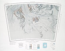
Dominion Range
The Rutkowski Glacier forms to the west of the Meyer Desert and flows south past Mount mills.
A conspicuous rock point marking the northern end of the Dominion Range and the confluence of the Beardmore and Mill Glaciers.
A triangular ice-free area of about 50 square nautical miles (170 km2; 66 sq mi) at the north end of the Dominion Range, near the confluence of the Beardmore and Mill Glaciers.
A bare rock butte at the north side of the mouth of Koski Glacier in the Dominion Range.
An east-flowing glacier, 6 nautical miles (11 km; 6.9 mi) long, draining the east-central portion of the Dominion Range icecap.
A mountain, 2,895 metres (9,498 ft) high, forming a part of the west escarpment of the Dominion Range, 4.5 nautical miles (8.3 km; 5.2 mi) north-northwest of Mount Nimrod.
A mountain, 2,835 metres (9,301 ft) high, standing 4 nautical miles (7.4 km; 4.6 mi) south-southeast of Mount Saunders in the Dominion Range.
A rocky peak, 2,895 metres (9,498 ft) high, in the Dominion Range, 2 nautical miles (3.7 km; 2.3 mi) south of Vandament Glacier.
A small cluster of rock nunataks 3 nautical miles (5.6 km; 3.5 mi) northwest of Mount Ward, the feature being a southern outlier of the main body of the Dominion Range.
A rock peak 3 nautical miles (5.6 km; 3.5 mi) southeast of Davis Nunataks, the feature being a southern outlier of the main body of the Dominion Range.