E4 European long distance path
From Dielsdorf, the E4 continues along the southern shores of Lake Constance via the following settlements to the village of Rheineck on the German border (150 km): Niederglatt – Bülach – Freienstein-Teufen – Irchel – Buch am Irchel – Dorf – Andelfingen – Truttikon – Oberstammheim – Stein am Rhein – Mammern – Steckborn – Berlingen – Mannebach – Ermatingen – Gottlieben – Kreuzlingen – Münsterlingen – Güttingen – Uttwil – Romanshorn – Egnach – Arbon – Steinach – Tübach – Goldach – Rorschacherberg – Buchberg – Rheineck Alternative 1: On the route of Nordalpine Weitwanderweg 01 (Nordalpine route 01) are exposed stretches - for experienced mountain walkers only 1.
You can find map sketches and description about the whole route in the book „Vom Neusiedler See zum Bodensee – Nordalpiner Weitwanderweg 01” in German.
[1] As an alternative to Romania a route for the E4 through Serbia has been described by the Serbian Mountain Association (Planinarski Savez Srbije).
It continues on the ridge until the Vinarska Porta saddle, and then runs along Tevno Lake and down the Zhelezina stream towards Pirin hut.
From there it is the only marked trail leading through the Central Pirin range, passing the peak Orelyak and the hut Popovi Livadi.
However, additional, current local information should be sought whenever possible and while a route exists from the Bulgarian border to the foot of the Peloponnese peninsula, it may be inadequately marked.
The Tourist Office comments further: "The areas have a typical Mediterranean climate, with warm dry summers and considerable differences in day and night temperatures.
[5] A walk can take longer than anticipated because of poor way marking, or because paths are blocked, or dangerously eroded, and streams and rivers may be impassable.
Walkers should therefore be prepared for long diversions, and never presume that you will reach the intended destination, including the final one, on time, or on a specific day.
Some mountain villages are uninhabited in the winter and will only begin to come alive again after Easter, and not fully until high summer.
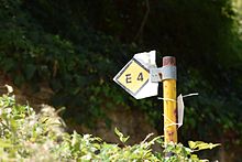
Coloured signs on rocks and trees: white background, a yellow parallelogram on the left and a black on the right.
Nymphaeo, Amyntaeo (Amyndeo), Rizomata, Dion, Litochoro (Litohoro), Olympus, Kokkinopilos, Meteora, Agrafa, Krassochori, Viviani (Viniani).
The first organized mapping and signage effort of the whole E4 in Crete was made by Giorgis N. Petrakis (Architect - Spatial Planner - Cartographer), and some indicative information on the segments of the trail can be found at : http://www.destinationcrete.gr/en/explore-the-island/e4-at-crete This new section of the E4 was inaugurated in 2005, and is 539 km long.
It connects Larnaka and Pafos international airports, traversing the Troodos mountain range and Akamas peninsula.
In 2014 the Orientaction club produced 1/25000 hiking maps of the mountainous region of Cyprus which include a large part of the E4 trail.