Inner Hebrides
[Note 1] Records for the last date of settlement for the smaller islands are incomplete, but most of them were inhabited at some point during the Neolithic, Iron Age, Early Historic or Norse periods.
[1] The main commercial activities are tourism, crofting, fishing and whisky distilling (centred on Islay but also including Talisker in Skye, Isle of Jura Single Malt and Tobermory and Ledaig in Mull).
However, the islands are well placed to exploit renewable energy, particularly onshore and offshore wind; and the Sleat peninsula of Skye is an example of a more economically robust area.
[25] Burnt hazelnut shells and microscopic charcoal found at Farm Fields, Kinloch on Rùm indicate a settlement of some kind and this is amongst the oldest evidence of occupation in Scotland.
[26][27][28] Evidence of large-scale Mesolithic nut processing, radiocarbon dated to circa 7000 BCE, has been found in a midden pit at Staosnaig on Colonsay.
The dig discovered the remains of hundreds of thousands of burned hazelnut shells[29][30] and gives an insight into communal activity and forward planning in the period.
[Note 2] There are numerous Iron Age sites including the remains of Dun Ringill fort on Skye, which are similar in layout to that of both a broch and a complex Atlantic roundhouse.
[36][Note 3] Other early written references include the flight of the Nemed people from Ireland to "Domon and to Erdomon in the north of Alba", which is mentioned in the 12th century Lebor Gabála Érenn.
Lismore in the territory of the Cenél Loairn, was sufficiently important for the death of its abbots to be recorded with some frequency and many smaller sites, such as on Eigg, Hinba and Tiree, are known from the annals.
This term was variously used in succeeding centuries to refer to individuals of mixed Scandinavian-Celtic descent and/or culture who became dominant in south-west Scotland, parts of Northern England and the isles.
[48] The early 10th century are an obscure period so far as the Hebrides are concerned[49] but Aulaf mac Sitric, who fought at the Battle of Brunanburh in 937 is recorded as a King of the Isles from c. 941 to 980.
[49] It is difficult to reconcile the records of the Irish annals with Norse sources such as the Orkneyinga Saga but it is likely that Norwegian and Gallgáedil Uí Ímair warlords fought for control for much of period from the 9th to the 12th centuries.
[52] By the late 12th century Irish influence became a significant feature of island life and Diarmait mac Maíl na mBó, the High King of Ireland took possession of Mann and the Isles until 1072.
[54] The ancestor of many of the succeeding rulers of Mann and the Isles, he was eventually ousted by Muirchertach Ua Briain and fled to Islay, where he died in the plague of 1095.
[54][55][56] It is not clear the extent to which Ui Briain dominance was now asserted in the islands north of Man, but growing Irish influence in these seas brought a rapid and decisive response from Norway.
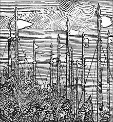
Some were restored for a promise of good behaviour, but MacDonald was unable to control his son Aonghas Óg, who defeated him at the Battle of Bloody Bay, fought off the coast of Mull near Tobermory in 1481.
[68] The MacDonalds of South Uist were bitter rivals of the MacLeods, and an attempt by the former to murder church-goers at Trumpan in retaliation for a previous massacre on Eigg, resulted in the Battle of the Spoiling Dyke of 1578.
[69][70] After the failure of the Jacobite rebellion of 1745, Flora MacDonald became famous for rescuing Prince Charles Edward Stuart from the Hanoverian troops.
With the implementation of the Treaty of Union in 1707 the Hebrides became part of the new Kingdom of Great Britain, but the clans' loyalties to a distant monarch were not strong.
[76] The British government's strategy was to estrange the clan chiefs from their kinsmen and turn their descendants into English-speaking landlords whose main concern was the revenues their estates brought rather than the welfare of those who lived on them.
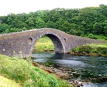
Roads and quays were built, the slate industry became a significant employer on Easdale and surrounding islands, and the construction of the Crinan and Caledonian canals and other engineering works such as Telford's "Bridge across the Atlantic" improved transport and access.
[78] However, in the mid-19th century, the inhabitants of many parts of the Hebrides were devastated by the clearances, which destroyed communities throughout the Highlands and Islands as the human populations were evicted and replaced with sheep farms.
[79] The position was exacerbated by the failure of the islands' kelp industry that thrived from the 18th century until the end of the Napoleonic Wars in 1815[80][81] and large scale emigration became endemic.
[1] Scheduled ferry services between the Inner Hebrides and the Scottish mainland operate on various routes including: Tayinloan, Kintyre to Gigha; Kennacraig, Kintyre to Islay; Oban to Mull, Coll and Tiree and Colonsay; Mallaig to Armadale, Skye and Eigg, Muck, Rùm & Canna; and Glenelg to Kyle Rhea on the Sleat peninsula, Skye.
Some ferries reach the Inner Hebrides from other islands such as the Seil to Luing route, Fionnphort on the Ross of Mull to Iona, Sconser to Raasay and Port Askaig to Feolin, Jura.
There is also a service to and from the Outer Hebrides from Tarbert, Harris and Lochmaddy on North Uist to Uig, Skye and from Castlebay, Barra to Tiree.
Originally it was considered to be an impossible site for a light, but the loss of the steamer Bussorah with all thirty-three hands on her maiden voyage in 1863 and of an astonishing 24 vessels in the area in a storm on 30–31 December 1865 encouraged positive action.
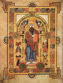
There have been speakers of Goidelic languages in the Inner Hebrides since the time of Columba or before, and the modern variant of Scottish Gaelic (Gàidhlig) remains strong in some parts.
Observing the local abundance found on Skye in the 18th century Samuel Johnson noted that: At the tables where a stranger is received, neither plenty nor delicacy is wanting.
[112] Mountain hare (apparently absent from Skye in the 18th century) and rabbit are now abundant and predated on by Scottish wildcat and pine marten.