Floods in Saint Petersburg
Floods are registered when the water rises above 160 cm with respect to a gauge at the Saint Petersburg Mining Institute.
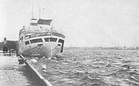
[1][2][3] The construction of Saint Petersburg Dam, started in 1978 and completed in 2011, is expected to protect the city from devastating floods.
Its first use to hold back the incoming Baltic water into Neva bay took place 28 November 2011 and had resulted in decrease of water rise to 1.3 MASL, that is below flood level equal to 1.6 masl,[5] which prevented the 309th flood in the history of the city and saved some 1.3 billion roubles of possible damage.
The water level rises because of the shallowness of Neva Bay, flatness of its bottom and the narrowing of the Gulf of Finland near the delta.
Swedish annals report that the water covered the entire area of the present St. Petersburg by 25 feet (7.6 meters).
The water rose much higher on 20 September 1706, which in his letter to Alexander Menshikov, Peter I described as "the west-south-west wind brought the flood undescribed before.
The dam is also the last completed part of the Saint Petersburg Ring Road, providing direct roadway access from mainland to the Kotlin Island and Kronshtadt.
The first use of the dam to hold back the incoming Baltic water into Neva bay took place 28 November 2011, when a major storm came from Scandinavia and caused a surge wave.