Storm surge
[1] The main meteorological factor contributing to a storm surge is high-speed wind pushing water towards the coast over a long fetch.
As extreme weather becomes more intense and the sea level rises due to climate change, storm surges are expected to cause more risk to coastal populations.
[4] In addition to the above processes, storm surge and wave heights on shore are also affected by the flow of water over the underlying topography, i.e. the shape and depth of the ocean floor and coastal area.
A narrow shelf, with deep water relatively close to the shoreline, tends to produce a lower surge but higher and more powerful waves.
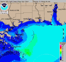
A wide shelf, with shallower water, tends to produce a higher storm surge with relatively smaller waves.
This is relatively steep and deep; storm surge is not as great but the waves are larger compared to the west coast of Florida.
On a shallow, gently sloping shelf, the surge has less room to disperse and is driven ashore by the wind forces of the hurricane.
During the event, winds from the east were present along the northern periphery of the low-pressure center for a number of days, forcing water into locations such as Chesapeake Bay.
[13] Surge can be measured directly at coastal tidal stations as the difference between the forecast tide and the observed rise of water.
[14] Another method of measuring surge is by the deployment of pressure transducers along the coastline just ahead of an approaching tropical cyclone.
Local topography, bay and river orientation, depth of the sea bottom, astronomical tides, as well as other physical features, are taken into account in a predefined grid referred to as a SLOSH basin.
[20] For hurricane evacuation studies, a family of storms with representative tracks for the region, and varying intensity, eye diameter, and speed are modeled to produce worst-case water heights for any tropical cyclone occurrence.
[1] Unexpected flooding in estuaries and coastal areas can catch populations unprepared, causing loss of life.
[30] Similarly educating coastal communities and developing local evacuation plans can reduce the relative impact on people.
[citation needed] They are open and allow free passage, but close when the land is under threat of a storm surge.
Another modern development (in use in the Netherlands) is the creation of housing communities at the edges of wetlands with floating structures, restrained in position by vertical pylons.
Other soft adaptation methods can include changing structures so that they are elevated to avoid flooding directly,[33] or increasing natural protections like mangroves or dunes.
This was the case on the western Florida coast in 2017, just before Hurricane Irma made landfall, uncovering land usually underwater.
[38] The deadliest storm surge on record was the 1970 Bhola cyclone, which killed up to 500,000 people in the area of the Bay of Bengal.
[39] The deadliest storm surge in the twenty-first century was caused by Cyclone Nargis, which killed more than 138,000 people in Myanmar in May 2008.
[44] The highest storm tide noted in historical accounts was produced by the 1899 Cyclone Mahina, estimated at almost 44 feet (13.41 m) at Bathurst Bay, Australia, but research published in 2000 concluded that the majority of this likely was wave run-up because of the steep coastal topography.