Fort Point, Boston
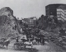
Between 1866 and 1872, the City of Boston undertook a redevelopment project on Fort Hill in attempt to add more land for business facilities.
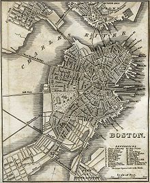
At its broadest extent, it includes the land a few blocks on either side of the Fort Point Channel (which due to landfill is considerably smaller than it was in colonial times).
The Boston Redevelopment Authority defines the Fort Point District within the neighborhood of South Boston as "an area of approximately 100 acres (0.40 km2) defined by the Fort Point Channel to the west, Summer Street to the north, the Bypass Road to the east, and West 2nd Street to the south.
The northeastern section of the Fort Point neighborhood, on the east side of the channel, could be said to overlap with the Financial District.
An alley between Thompson Place and Farnsworth Street provided the setting for the fictional address "344 Wash." The dramatic views of downtown Boston from the rooftops of Fort Point were prominently featured in the film.
The Silver Line (MBTA) bus rapid transit (BRT) system serves parts of Fort Point.