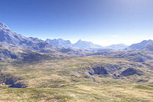
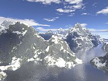
Fractal landscape
[3] The modeling of the Earth's rough surfaces via fractional Brownian motion was first proposed by Benoit Mandelbrot.
In particular, many studies of natural phenomena, even those commonly thought to exhibit fractal behavior, do not do so over more than a few orders of magnitude.
Thus, any real approach to modeling landscapes requires the ability to modulate fractal behavior spatially.
Real landscapes also have features originating with the flow of water and ice over their surface, which simple fractals cannot model.
More sophisticated techniques (known as 'multi-fractal' techniques) use different fractal dimensions for different scales, and thus can better model the frequency spectrum behavior of real landscapes[10] A way to make such a landscape is to employ the random midpoint displacement algorithm, in which a square is subdivided into four smaller equal squares and the center point is vertically offset by some random amount.