French Geodesic Mission to the Equator
[1] La Condamine had a marble plaque prepared, with a bronze exemplar (varilla metalica) of the length of such a pendulum set into it, which he presented to the Jesuit College of San Francisco in Quito in 1742, engraved with an inscription reading: Penduli simplicis aequinoctialis, unius minuti secundi temporis medii, in altitudine Soli Quitensis, archetypus (mensurae naturalis exemplar, utinam et universalis) ["Archetype of the equinoctial simple pendulum, of one second of a minute of mean time at the latitude of Quito (a natural and, may it be, a universal model of measure)"].
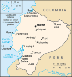
[2][3] Bouguer, La Condamine, Godin and their colleagues measured arcs of the Earth's curvature on the Equator from the plains near Quito to the southern city of Cuenca.
The French Academy of Sciences had commissioned an expedition led by Jean Baptiste Joseph Delambre and Pierre Méchain, lasting from 1792 to 1799, which attempted to accurately measure the distance between a belfry in Dunkerque and Montjuïc castle in Barcelona at the longitude of Paris Panthéon.
They did this in spite of earlier news that the expedition to Lapland led by Maupertuis had already finished their work and had proven that the Earth is oblate; i.e., flattened at the poles.
The only two members of the French mission to spend the entire time in Ecuador were Lieutenant (later General) Georges Perrier and medical officer Paul Rivet, later an important anthropologist and founder of the Musée de l'Homme in Paris.
A reproduction of the pyramids that marked the baseline for measurement at Yaruqui (which was destroyed by Quito authorities in the 1740s) was erected in 1836, the centennial of the expedition, by the Rocafuerte administration of the nascent republic of Ecuador.
This monument fell into disrepair over the next century but was rebuilt in 1936, minus its original French inscription, for the bicentennial of the first geodesic expedition, along with a second pyramid at San Antonio de Pichincha on the Equator.
Though talks of having a mural celebrating the Geodesic Mission took place during planning stages, no acknowledgement of the scientific importance of this site currently exists.
In 1936, the French American Committee of Ecuador sponsored the idea of the Ecuadoran geographer Dr. Luis Tufiño and raised a monument commemorating the bicentennial of the arrival of the First Geodesic Mission.