GL postcode area
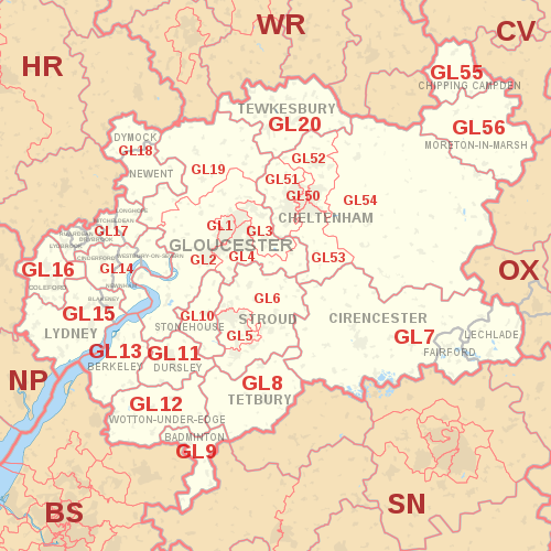
The GL postcode area, also known as the Gloucester postcode area,[2] is a group of 27 postcode districts in south-west England and a very small part of south-east Wales, within 28 post towns.
These cover most of Gloucestershire, including Gloucester, Cheltenham, Stroud, Cirencester, Tewkesbury, Badminton, Berkeley, Blakeney, Chipping Campden, Cinderford, Coleford, Drybrook, Dursley, Dymock, Fairford, Lechlade, Longhope, Lydbrook, Lydney, Mitcheldean, Moreton-in-Marsh, Newent, Newnham, Ruardean, Stonehouse, Tetbury, Westbury-on-Severn and Wotton-under-Edge.
The area also covers very small parts of Herefordshire, Worcestershire, Warwickshire, Oxfordshire and Wiltshire, while the GL16 district extends across the Welsh border to cover a very small part of Monmouthshire.
The area's districts are numbered sequentially from GL1 to GL20, then from GL50 to GL56 for Cheltenham and settlements immediately around and to its east.
GL17 has the most alternative post towns in England: covering an upper part of the Forest of Dean studded with isolated large villages, five are recognised as post towns within one postcode district.