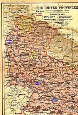
Ganges Canal
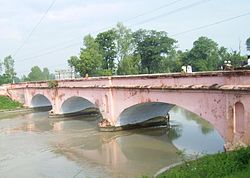
Separate navigation channels with lock gates were provided on this system for boats to negotiate falls.
The canal system irrigates nearly 9,000 km² of fertile agricultural land in ten districts of Uttar Pradesh and Uttarakhand.
There are some small hydroelectric plants on the canal capable of generating about 33 MW if running at full capacity these are at Nirgajini, Chitaura, Salawa, Bhola, Jani, Jauli and Dasna.
The Upper Ganges canal is the important and the original Ganges Canal, which starts at the Bhimgoda Barrage near Har ki Pauri at Haridwar, traverses Roorkee, Purquazi, Sardhana (Meerut district), Muradnagar, Dasna, Bulandshahr, Khurja, Harduaganj and continues to Nanau (near Akrabad) in Aligarh district, where it bifurcates into the Kanpur branch and Etawah branch.
This branch, starting at village Jera in Mainpuri district, runs for 166 km to reach Kanpur.
An irrigation system was felt necessary after the disastrous Agra famine of 1837–38, in which nearly 800,000 people died, and nearly ten million rupees was spent on relief works, resulting in considerable loss of revenue to the British East India Company.
Near Roorkee, the land fell away sharply and Cautley had to build an aqueduct to carry the canal for half a kilometre.
The Lower Ganges Canal, with a feed from a channel from Narora, was constructed into the ghar tract of Etawah, and became the Bhognipur branch.