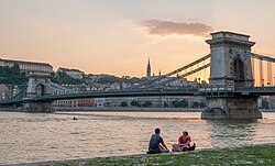
Geography of Europe
Some geographical texts refer to a Eurasian continent given that Europe is not surrounded by sea and its southeastern border has always been variously defined for centuries.
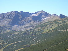
The southern regions are mountainous while moving north the terrain descends from the high Alps, Pyrenees, and Carpathians, through hilly uplands, into broad, low northern plains, which are vast in the east.
An arc of uplands also exists along the northwestern seaboard, beginning in southwestern Ireland, continuing across through western and northern Great Britain, and up along the mountainous, fjord-cut spine of Norway.
Sub-regions such as Iberia and Italy contain their own complex features, as does mainland Europe itself, where the relief contains many plateaus, river valleys, and basins that complicate the general trend.
The former is of North Atlantic volcanic formation, while the latter consist of upland areas once joined to the mainland until cut off by rising sea levels.
[2] A prehistoric perspective would include Britain and Ireland as the core of a further very significant European peninsula prior to the post-glacial rise in sea-levels.
The geology of Europe is hugely varied and complex, and gives rise to the wide variety of landscapes found across the continent, from the Scottish Highlands to the rolling plains of Hungary.
Several climatic zones intersect the continent, influenced by factors such as latitude, proximity to water bodies, elevation, and prevailing wind patterns.
The North Atlantic Drift, a warm ocean current, significantly moderates temperatures across much of Western Europe, resulting in relatively mild winters for regions at similar latitudes elsewhere.
This effect is particularly evident in countries such as the United Kingdom, Ireland, and coastal Norway, which experience oceanic climates characterized by cool summers and mild, wet winters.
Eastern Europe and parts of the continent's interior feature continental climates with more pronounced seasonal temperature differences, including cold winters and warm summers.
Northern Europe, including Scandinavia, is characterized by subarctic and tundra climates, where winters are long and harsh, and summers are short and cool.
The landlocked countries in Europe are: Andorra, Armenia, Austria, Belarus, Czech Republic, Hungary, Kosovo, Liechtenstein (which is doubly landlocked), Luxembourg, North Macedonia, Moldova, San Marino, Serbia, Slovakia, Switzerland, Vatican City Switzerland, Liechtenstein, Austria, Czech Republic, Slovakia, Hungary, Serbia, and North Macedonia constitute a contiguous landlocked agglomeration of eight countries in Central Europe and the Balkans, stretching from Geneva all the way to Skopje.