Geography of Washington, D.C.
The city contains the remaining federal district, which was formerly part of those two adjacent states before they respectively ceded it for the national capital in the 1790s.
The bottom of the bowl, where the White House and United States Capitol are located, is in the floodplain of the junction of the Anacostia and Potomac Rivers.
The highest of these terraces is 200 feet above sea level and is fronted by an escarpment that is very prominent along the east side of the Anacostia River.
Steep-sided ravines and small streams cut through the upper terrace east of the Anacostia River at frequent intervals.
[1] Washington, D.C. is located on the fall line, the border of two considerably different geological terrains or provinces; the hard rock of the Piedmont Plateau to the north and west and the soft sediments of the Atlantic Coastal Plain to the east.
In March 1828, President John Quincy Adams felt a "violent" earthquake in the White House and wrote it in his journal.
[12] As implied in the previous sentence, the downtown area exhibits an urban heat island (UHI) build-up that can especially exacerbate the sultriness of summer nights.
The Residence Act of 1790 required that the capital's territory would be located along the Potomac River within an area that Maryland and Virginia would cede to the federal government.
President Washington then chose for the territory a square whose sides were 10 miles (16 km) in length and whose corners were directly north, east, south, and west of its center.
[26][27] The Residence Act had granted the president the authority to locate the federal capital's territory only as far south and east as the mouth of the Anacostia River in Maryland.
However, President Washington wanted to expand the territory's area southward so that its boundaries could encompass the town of Alexandria.
In 1791, Congress amended the Residence Act to approve President Washington's selected site, which included the portion of the territory that Virginia would cede.
[28] During 1791–1792, Andrew Ellicott and several assistants, including Benjamin Banneker, surveyed the boundary between the federal territory and the states of Virginia and Maryland, placing marker stones at every mile point.
[30][31] Although L'Enfant designed the city's original layout in 1791, surveyor Andrew Ellicott revised it in 1792 (see Streets and highways of Washington, D.C.).
To preserve the grandeur of the National Mall, the White House, the Capitol, and various other key locations, the entire city is subject to strict building height limits.
This limitation was placed in effect just before the 20th century when government officials realized that structural steel "skyscrapers" could overwhelm the city.
Contrary to popular belief, no law has ever restricted buildings to the height of the United States Capitol or Washington Monument.
The newer legislation, still in effect today, states that no new building may be more than 20 feet taller than the width of the street in front of it.
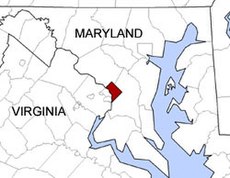
In addition to the places named above, there are other small unincorporated parts of Prince George's County, Maryland, which also border Washington, D.C.