Geology of Chile
In the Late Cenozoic, Chile definitely separated from Antarctica, and the Andes experienced a significant rise accompanied by a cooling climate and the onset of glaciations.
The mountains run parallel in a north–south direction from Morro de Arica to Taitao Peninsula, making up most of Chile's land surface.
At a south latitude of 27 degrees, Chile's highest mountain (Ojos del Salado) reaches a height of 6,893 metres (22,615 ft).
Below 42 degrees south, the Andes split into a fjord landscape and the highest mountain is Monte San Valentin at 4,058 metres (13,314 ft) at north of Northern Patagonian Ice Field.
The Intermediate Depression, a series of faults running north to south, separates the Andes from the Coast Range with a steady decrease in altitude as the latitude increases.
In Norte Grande the Intermediate Depression is partially covered by a series of salt flats, and has the world's largest potassium nitrate deposits.
The range, a combined horst, forearc high and accretionary wedge, was separated from the Andes during the Tertiary rise due to the subsidence of the Intermediate Depression.
During the Triassic Period about 250 million years ago Chile was part of the supercontinent Pangaea, which concentrated the world's major land masses.
Across the 1,000-kilometre (620 mi)-wide Drake Passage lie the mountains of the Antarctic Peninsula, south of the Scotia plate, which appear to be a continuation of the Andes.
During the Cretaceous, the Andes began to assume their present form by the uplifting, faulting and folding of sedimentary and metamorphic rocks of ancient cratons.
Tectonic forces along the subduction zone along the west coast of South America continue to their orogenesis, resulting in earthquakes and volcanic eruptions to this day.
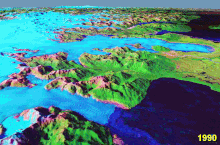
During the Santa María glaciation glaciers extended into the Pacific Ocean at 42° south, dividing the Chilean Coast Range and creating what is now Chacao Channel.
Robinson Crusoe is the largest of the islands at 93 square kilometres (36 sq mi), and its highest peak (El Yunque) is 916 metres (3,005 ft) high.
[3] Most of Chile's mineral resources are in the north; gas, coal and oil reserves, in the southern Magallanes Region, are sufficient for local needs.
The Chilean company Geotermia del Pacífico, with support from CORFO, is exploring a location in Curacautín as a site for a geothermal power plant.
Geotermia del Pacífico's studies indicated that two geothermal fields near Curacautín could be used for energy production, with a combined capacity to supply 36,000 homes in 2010.
Those affecting coastal regions are generally aligned offshore from Concepción southward, with the major epicenters producing a predictable pattern of seismic and tsunami effects.
Earthquakes near the Moho may account for permanent deformation of the western edge of South American plate that accumulates into a long-term net uplift of the continent.
[8] The phenomenon of comparably-large quakes on the same (or neighboring) faults within months of each other may be explained by geological mechanisms, but this does not fully demonstrate a relationship between events separated by longer periods and greater distances[9]


Area of the city most affected by earthquake
City blocks most damaged by fire