Geology of the Lake District
The geology of England's Lake District is dominated by sedimentary and volcanic rocks of mainly Ordovician age underpinned by large granitic intrusions.
In early Paleozoic times the area was on the northern margin of the microcontinent of Avalonia, which was moving northwards as the Iapetus Ocean began to close.
Initial deepwater sedimentation recorded by the Skiddaw Group was followed by the development of a continental arc caused by the subduction of Iapetus oceanic crust beneath the Avalonian margin.
As the collision progressed the Lake District area became part of a foreland basin in which the Windermere Supergroup sediments were deposited, initially interfingering with the volcanics and then overlaying them.
The collision reached its end during the Early Devonian, part of the Acadian Orogeny with the final closure of Iapetus and the intrusion of late orogenic granites.
[2] Following deformation and low-grade metamorphism during the Acadian Orogeny, they now have a well-developed slaty cleavage, giving rise to their common name, the Skiddaw Slates.
The group is divided into two main areas, the northern and central fells, to either side of the WSW-ENE trending Causey Pike Fault, with distinct successions developed.
It consists of a thick sequence of basaltic, andesitic, dacitic and rhyolitic lavas and pyroclastic rocks with interbedded volcaniclastic sediments.
The Birker Fell Andesite Formation makes up most of the lower BVG, varying in thickness from 980 m to 2700 m.[7] The upper part of the group consists of mainly intermediate to acidic pyroclastic rocks and interbedded volcaniclastic sediments.
The youngest unit is the Ludlow to Pridoli Kendal Group, which consists of couplets of graded siltstone and mudstone, locally with thick turbiditic sandstones.
The earlier Ordovician granites were intruded at the same time as the BVG, representing the solidified magma chambers related to the volcanics, which later uplift has now exposed at the surface.
[11] After the end of the Acadian collision, Northern England was affected by a phase of Early Carboniferous extension, possibly related to the subduction of Rheic Ocean crust beneath Gondwana.
However, based on the analysis of apatite fission tracks (AFTA) and estimates from neighbouring preserved sequences, it is thought that the Lake District was covered by between about 700 to 1750 m of Triassic, Jurassic and Cretaceous sediments by the Palaeocene that has since been removed by erosion.
The timing of the exhumation that removed the Mesozoic section from the top of the Lake District massif remains uncertain, although a significant part of the uplift is thought to have been caused by underplating at the end of the Paleocene.
The north-dipping Maryport Fault formed on its northern margin as part of the regional Early Carboniferous extensional event, possibly reactivating an Acadian thrust structure.
In late Permian to Triassic times the Lake District Boundary Fault was an active extensional structure, forming part of the margin to the East Irish Sea Basin.
[17] Copper mineralisation is mainly hosted by the Borrowdale Volcanic Group, with particularly important veins found in the Coniston, Haweswater and Ulpha areas.
[17] Iron mineralisation, in the form of haematite veins, occurs across the northern and western Lake District, hosted particularly in the Skiddaw Group slates.
The most significant haematite mineralisation, however, is in the form of large orebodies replacing Carboniferous limestone in the West Cumbrian iron orefield on the western margin of the Lake District.
The same iron-rich fluids moving eastwards away from the basin within the sedimentary cover sequence would then have had access to open fractures in the Ordovician rocks, forming the vein deposits there.
[17] The Lake District has a long history of mining and quarrying going back to at least Neolithic times, with the stone axe factory at Langdale.
The earliest records of mineral extraction in the Lake District is evidence of haematite mining in the Iron Age in Furness and during Roman times in West Cumbria.
[20] There are more than a dozen individual mines in the area of the Caldbeck Fells, which were an important source of copper, lead, arsenic, baryte and tungsten from the 16th century up to the 1980s.
The german miners brought in to work it by the Mines Royal named it "Gottesgab" (God's gift) due to the richness of the copper deposit, which became corrupted over time to "Goldscope".
[26][27] Large deposits of hematite hosted in Carboniferous Limestone, were exploited by a series of mines on the northwestern margin of the Lake District.
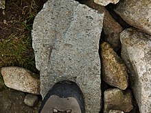
[29] The strongly cleaved volcaniclastic units (tuffs) within the BVG have in contrast locally produced good quality slates that have been widely quarried and more recently extracted by mining.
Several different bands of slate have been worked across the outcrop, for instance at Buttermere, along Borrowdale (Honister, Yewcrag, Rigg Head and Castle Crag) and from the Duddon Estuary up to Mosedale (including Broughton Moor, Kirskstone and Coniston).
Red Penrith Sandstone and Brockram breccia of the Permian Appleby Group have been used as building stone in the area of their outcrop to the east and south of the Lake District.
Higher specification aggregates, such as those required for road surfacing, however, come mainly from sandstones and igneous rocks, both volcanic (BVG) and intrusive (various granitic bodies).
The single quarry producing very high specification aggregate is at Ghyll Scaur, just north of Millom, which is the only currently available source for this quality of roadstone in England.


photographed in May 2009


