Lower Coastal Plain (Georgia)
[1] It differs from Georgia's Upper Coastal Plain in that it is lower in elevation with less relief and wetter soils.
The Coastal Plain is also the home to Savannah, the first capital city which was declared in 1733.
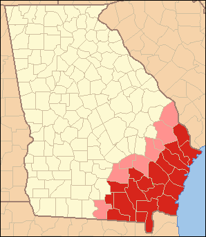
The subregion is somewhat synonymous with Coastal Georgia,[2] and contains the counties of Atkinson, Bacon, Brantley, Camden, Charlton, Clinch, Echols, Glynn, Lanier, Pierce, Ware, and Wayne, south of the Altamaha River; and Bryan, Chatham, Effingham, Liberty, Long, and McIntosh, north of the Altamaha River.
[4] The largest census county divisions, in the order of decreasing population, are Savannah, Hinesville, Pooler–Bloomingdale, Brunswick, Saint Marys, Waycross, Jesup, Richmond Hill, Tybee Island, and Everett.
[5] The total population of the eighteen-county subregion is 726,132 (286,271 south of, and 439,861 north of, the Altamaha River), as of the 2010 U.S.