Georgia State Route 3
Here, US 19 travels concurrent with State Road 57, 12 miles (19 km) south-southeast of Thomasville.
SR 3 travels through portions of Thomas, Mitchell, Dougherty, Lee, Sumter, Schley, Taylor, Upson, Pike, Spalding, Henry, Clayton, Fulton, Cobb, Bartow, Gordon, Whitfield, and Catoosa counties to its northern terminus at the Tennessee state line, in East Ridge, where US 41/US 76 continue, concurrent with State Route 8.
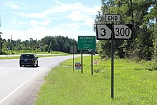
SR 3 turns slightly northeast in Camilla and heads through Baconton, Georgia to Albany in Dougherty County, where its concurrency with SR 300 ends, before turning north and heading to Leesburg in Lee County.
In Leesburg, the highway turns slightly northwest once more, travels through Smithville, and enters Sumter County.
Turning north again, SR 3 continues through Americus and enters Schley County, curving slightly northwest to Ellaville.
Heading north, the route enters the western portion of Henry County, and heads through Hampton, where the Atlanta Motor Speedway has direct access from the highway, which regularly sees massive backups on weekends when NASCAR races take place there.
Continuing north into Clayton County, SR 3 heads through Jonesboro, and crosses I-75 in Morrow.
Heading north through Forest Park, the highway first enters Fulton County, then crosses I-285, and I-75 again, as well as I-85, in quick succession, as it makes its way through the southern Atlanta suburban communities of Hapeville and East Point, forming one side of the perimeter of Hartsfield-Jackson Atlanta International Airport near Hapeville.
Turning north, the highway parallels the Downtown Connector very closely, crosses I-20 in downtown Atlanta, and continues north, beginning and ending concurrencies with US 19, US 78, and US 278, as well as forming part of the western boundary of the campus of Georgia Tech.
Heading through Dalton, the route crosses I-75 yet again, before heading northwest into Catoosa County, where it crosses I-75 for the seventh and final time, before reaching its northern terminus at the Tennessee state line, south of Chattanooga.
The following portions of SR 3 are part of the National Highway System, a system of routes determined to be the most important for the nation's economy, mobility, and defense: SR 3 was established at least as early as 1919 starting at the Florida state line southwest of Thomasville; no numbered highway extended south-southeast from that city at the time.
[2] By the end of 1926, US 41 had been designated on the entire length of SR 3 from Griffin to the Tennessee state line.
Four segments of SR 3 had a completed hard surface: from Thomasville to Albany, from Leesburg to Ellaville, from south-southeast of Thomaston to north-northwest of that city, and from north-northeast of Zebulon to Ringgold.
Two segments had a sand clay or top soil surface: from Butler to south-southeast of Thomaston and from north-northwest of that city to north-northeast of Zebulon.
From the Florida state line to Thomasville and a segment north-northeast of Zebulon were indicated to be under construction.
[12][13] In January 1932, the entire highway from Florida to north of Ellaville had a completed hard surface.
[13][14] In April that year, the entire highway from south-southeast of Thomaston to the Tennessee state line had a completed hard surface.
[15][16] Later that year, the segment from north of Ellaville to Butler had a sand clay or top soil surface.
The segment from the south end of the SR 22 concurrency to south-southeast of Thomaston had completed grading, but had no surface course.
[22][23] In 1934, the segment north of Ringgold was shifted west to travel northwest from that city.
[24][25] By the end of the year, a segment of SR 35 south-southeast of Thomasville had a completed hard surface.
[32][33] Later that year, all of SR 3E from Atlanta to northwest of the Fulton–Cobb county line had a completed hard surface.
[37][38] By the end of 1946, SR 3W was projected to be designated from the western part of Albany to US 19/SR 3 north of the city.
[44][45] The next year, US 19/US 41/SR 3 was shifted eastward onto the "Expressway" in the southern part of Atlanta, traveled west on Lakewood Avenue, and then resumed the northern path.
[57][58] In 1974, a freeway was built on the northern extension of SR 333 in Albany, but there was no indication as to what highways were designated on it.
[58][59] Three years later, US 19 through the main part of Albany was shifted northeast to travel concurrently with the SR 333 freeway.
[2] By the end of 1926, a segment north-northwest of Thomasville had a "sand clay or top soil" surface.
At least as early as 1919, SR 3 traveled on essentially the same path as it currently does through the Albany metropolitan area.
[9][10] By the end of 1946, SR 3W was projected to be designated from the western part of Albany to US 19/SR 3 north of the city.
[3] The portion of Tara Boulevard in Clayton County that is not covered by US 19/US 41/SR 3 near Interstate 75 (I-75) is designated as State Route 3 Connector (SR 3 Conn.).