Geothermal gradient
[1] However, in some cases the temperature may drop with increasing depth, especially near the surface, a phenomenon known as inverse or negative geothermal gradient.
[13] The top hundreds of meters reflect past climate change;[14] descending further, warmth increases steadily as interior heat sources begin to dominate.
Highly viscous or partially molten rock at temperatures between 650 and 1,200 °C (1,200 and 2,200 °F) are found at the margins of tectonic plates, increasing the geothermal gradient in the vicinity, but only the outer core is postulated to exist in a molten or fluid state, and the temperature at Earth's inner core/outer core boundary, around 3,500 kilometres (2,200 mi) deep, is estimated to be 5650 ± 600 Kelvin.
[1] In Earth's continental crust, the decay of natural radioactive nuclides makes a significant contribution to geothermal heat production.
The continental crust is abundant in lower density minerals but also contains significant concentrations of heavier lithophilic elements such as uranium.
[19] Naturally occurring radioactive elements are enriched in the granite and basaltic rocks, especially in layers closer to Earth's surface.
The mantle is mostly made up of high density minerals with higher concentrations of elements that have relatively small atomic radii, such as magnesium (Mg), titanium (Ti), and calcium (Ca).
[24] Earth's crust effectively acts as a thick insulating blanket which must be pierced by fluid conduits (of magma, water or other) in order to release the heat underneath.
Global data on heat-flow density are collected and compiled by the International Heat Flow Commission (IHFC) of the IASPEI/IUGG.
The geothermal gradient has been used for space heating and bathing since ancient Roman times, and more recently for generating electricity.
This has caused a growing interest in finding sources of energy that are renewable and have reduced greenhouse gas emissions.
Generating electrical power from geothermal resources requires no fuel while providing true baseload energy at a reliability rate that constantly exceeds 90%.
[1] The geothermal gradient varies with location and is typically measured by determining the bottom open-hole temperature after borehole drilling.
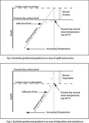
In stable tectonic areas in the tropics, a temperature-depth plot will converge to the annual average surface temperature.
However, in areas where deep permafrost developed during the Pleistocene, a low temperature anomaly can be observed that persists down to several hundred metres.
[29][30] Melt water from the polar ice caps flowing along ocean bottoms tends to maintain a constant geothermal gradient throughout Earth's surface.