Gohain Kamal Ali
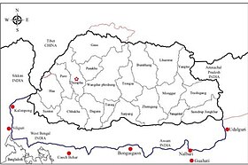
Gohain Kamal Ali was an embanked road that connected the capital of the Koch dynasty, Cooch Behar in North Bengal to heart of Agomani in Dhubri and Narayanpur in Lakhimpur district in Assam, and ran along the foot of the Bhutan hills and the Dafla (Nishi) hills.
[1] This was constructed under the supervision of Gohain Kamal, the step-brother of the king, Nara Narayan and was completed in 1547.
In 1562 Naranarayan encamped at Chandikabehar, Mangaldai, he demarcated the region north of the road as where the Koch and the Mech people were to follow their tribal customs, and region south where Brahminic rites were to be followed.
[4] From the early 17th-century, the Kingdom of Bhutan pushed south and took control of the fertile plains down to Gohain Kamal Ali road.
[5][6] Ahom King Gaurinath Singha (1780–1795) had fixed this road as the northern boundary of Darrang.