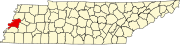
Golddust, Tennessee
[3] In 1861, the Confederate States Army built extensive fortifications south of Golddust and named the site for General Gideon J. Pillow.
Because of its strategic location overlooking the Mississippi River, the Union Army took control of the fort in 1862 after the Confederates left.
Fort Pillow State Park is located approximately 3 miles (4.8 km) south of Golddust.
Golddust is situated on the southeastern edge of the New Madrid Seismic Zone, an area with a high earthquake risk.
After the abolition of slavery, sharecropping was the primary means of income for both black and white families in the area.