Grand Mesa
The north side of the mesa is drained largely by Plateau Creek, a smaller tributary of the Colorado.
Over 300 lakes, including many reservoirs created and used for drinking and irrigation water, are scattered along the top of the formation.
[3] The top layer rests on a thick sequence of Eocene shale and sandstone known as the Green River and Wasatch Formations.
The top of the mesa is more than 2 miles (3,220 m) above sea level, and experiences an alpine climate with substantial amounts of precipitation throughout the year.
On the north side, the road climbs the steep terrain near the Powderhorn Resort ski area.
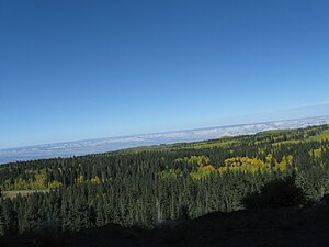
The forested top of the mesa remains snowbound much later in the spring than the surrounding valleys, and is a popular location for cross-country skiing and snowmobiling.