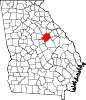
Hancock County, Georgia
[2] The county was created on December 17, 1793, and named for John Hancock, a Founding Father of the American Revolution.
[3][4] Before the Civil War, Hancock County was developed for cotton plantations, as international demand was high for the commodity.
This area is classified as part of the Black Belt of the United States, primarily due to its fertile soil.
After emancipation and granting of citizenship and the franchise, most freedmen joined the Republican Party, which they credited with gaining their freedom.
In August 2015, the majority-white Hancock County Board of Elections initiated an effort to purge voters from the rolls.
[10] The western portion of Hancock County, which is defined by a line running southeast from White Plains to the intersection of State Route 22 and Springfield Road, then running southwest along State Route 22, is located in the Upper Oconee River sub-basin of the Altamaha River basin.
But the composition of the party voters and policies they support have undergone major changes since the late twentieth century, switching from whites to African Americans.
In 1980 Hancock County gave "favorite son" candidate Jimmy Carter his second highest vote share in the nation.