Hinterriß
Hinterriß is a Tyrolean village in Schwaz District, Austria, located at the Rißbach river at a height of 928 metres.
In the other direction, a toll road of 15 km accessible only in summer connects Hinterriß with the small village of Eng at the end of the valley.
[2] At the end of the Rißbach valley, between 1080 and 1300m just before the village of Eng in the municipal area of Vomp lies the "Große Ahornboden" ("large maple grove").
[4] In December 1988, the Große Ahornboden was designated as Protected Landscape Area, which includes 267,28 Hectare[5] It is also part of the Karwendel Nature Park.
[4] The "Kleine Ahornboden" is located at the southern end of the Johannestal at around 1400 metres altitude directly below the steeply sloping north faces of the Hinterautal-Vomper Chain.
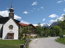
The miners built a small chapel "Maria auf der Schmelz", which over time became the destination of a lively pilgrimage, especially from the Bavarian region.
The settlement at that time consisted of church and Widum;including stable and barn as well as a forester’s house and individual scattered buildings and pastures in the area.