History of synthetic-aperture radar
Carl A. Wiley,[1] a mathematician at Goodyear Aircraft Company in Litchfield Park, Arizona, invented synthetic-aperture radar in June 1951 while working on a correlation guidance system for the Atlas ICBM program.
[2] In early 1952, Wiley, together with Fred Heisley and Bill Welty, constructed a concept validation system known as DOUSER ("Doppler Unbeamed Search Radar").
In essence, signal strength in isolated discrete bands of Doppler frequency defined image intensities that were displayed at matching angular positions within proper range locations.
Displaying returns from several adjacent non-zero Doppler frequency bands accomplished further "beam-subdividing" (sometimes called "unfocused radar", though it could have been considered "semi-focused").
of Defense summer study conference called TEOTA ("The Eyes of the Army"),[6] which sought to identify new techniques useful for military reconnaissance and technical gathering of intelligence.
The subsequent summation, or integration, step of the correlation was to be done by converging appropriate sets of multiplication products by the focusing action of one or more spherical and cylindrical lenses.
The key to obtaining, from the converging wave component, focused images that are not overlaid with unwanted haze from the other two is to block the latter, allowing only the wanted beam to pass through a properly positioned frequency-band selecting aperture.
Although creating that radar was a more straightforward task based on already-known techniques, that work did demand the achievement of signal linearity and frequency stability that were at the extreme state of the art.
It was understood that finer resolution would require the added development of means for sensing departures of the aircraft from an ideal heading and flight path, and for using that information for making needed corrections to the antenna pointing and to the received signals before processing.
Although the program had been considered for termination by DoD due to what had seemed to be a lack of results, that first success ensured further funding to continue development leading to solutions to those recognized needs.
A technical article in the journal of the IRE (Institute of Radio Engineers) Professional Group on Military Electronics in February 1961[10] described the SAR principle and both the C-46 and AN/UPD-1 versions, but did not tell how the data were processed, nor that the UPD-1's maximum resolution capability was about 50 feet (15 m).
The lessons it provided were well learned by subsequent researchers, operational system designers, image-interpreter trainers, and the DoD sponsors of further development and acquisition.
That work, depending on advanced radar circuit designs and precision sensing of departures from ideal straight flight, along with more sophisticated optical processors using laser light sources and specially designed very large lenses made from remarkably clear glass, allowed the Michigan group to advance system resolution, at about 5-year intervals, first to 15 feet (4.6 m), then 5 feet (1.5 m), and, by the mid-1970s, to 1 foot (the latter only over very short range intervals while processing was still being done optically).
The latter levels and the associated very wide dynamic range proved suitable for identifying many objects of military concern as well as soil, water, vegetation, and ice features being studied by a variety of environmental researchers having security clearances allowing them access to what was then classified imagery.
Even the 5-foot (1.5 m) resolution stage had over-taxed the ability of cathode-ray tubes (limited to about 2000 distinguishable items across the screen diameter) to deliver fine enough details to signal films while still covering wide range swaths, and taxed the optical processing systems in similar ways.
Early experience with artificial earth satellites had also demonstrated that the Doppler frequency shifts of signals traveling through the ionosphere and atmosphere were stable enough to permit very fine resolution to be achievable even at ranges of hundreds of kilometers.
That seemingly slow rate of advances was often paced by the progress of other inventions, such as the laser, the digital computer, circuit miniaturization, and compact data storage.
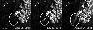
The Lunar Reconnaissance Orbiter, launched in 2009, carries a SAR instrument called Mini-RF, which was designed largely to look for water ice deposits on the poles of the Moon.
The Mineseeker Project is designing a system for determining whether regions contain landmines based on a blimp carrying ultra-wideband synthetic aperture radar.
The National Reconnaissance Office maintains a fleet of (now declassified) synthetic aperture radar satellites commonly designated as Lacrosse or Onyx.
In February 2009, the Sentinel R1 surveillance aircraft entered service in the RAF, equipped with the SAR-based Airborne Stand-Off Radar (ASTOR) system.