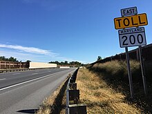
Maryland Route 200
[4] They also argued that "environmental degradation would immediately occur from the construction (loss of forests, wetlands, and animal habitats), [and instill] long-term consequences (air pollution and carbon emissions from additional driving, more sprawl development, less money to fund mass transit projects, etc.).
"[5] Fulfilling a 2002 campaign promise, Maryland Governor Robert Ehrlich pushed to begin construction of the road and conducted a formal groundbreaking in October 2006.
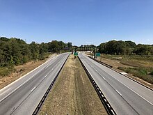
MD 200 shortly curves to the east on the approach to the six-lane overpass for Olde Mill Run, which was built wide enough for a fourth lane in the eastbound direction.
The route continues eastward, featuring a partial interchange with Briggs Chaney Road (westbound exit and eastbound entrance), and then, just after crossing the border into Prince George's County, it passes over the Little Paint Branch just south of the Fairland Recreational Park.
Because of these concerns, the Maryland State Roads Commission moved the proposed Outer Beltway to a route north of Rockville and eliminated a new bridge crossing the Potomac River.
[21] In 1984, Maryland Secretary of Transportation Lowell K. Bridwell designated land in Montgomery and Prince George's counties as the future site of the Intercounty Connector so that the right-of-way would be preserved,[22] even though Montgomery County Executive Charles W. Gilchrist had voiced very critical comments about the Intercounty Connector as it was envisioned in 1983—at least in part because he felt that construction of the ICC by the year 2000 was "infeasible", and advocated construction of a "shorter and less-costly" east–west highway instead.
[23] Prior to Governor Parris N. Glendening declaring the Intercounty Connector "dead" before leaving office in January 2003, two environmental impact studies had been conducted, the first being a draft document in 1983.
By 1997, millions of dollars had been spent on planning and preliminary engineering, but the only segments of the road that had been built were I-370 between I-270 and the Shady Grove Metrorail station on WMATA's Red Line.
[26] After the 1997 Intercounty Connector Draft Environmental Impact Statement process was put on hold by Governor Glendening, much controversy resulted between groups and persons in favor of the ICC and those opposed.
[34] At its final meeting in June 1999, the Transportation Solutions Group held a public hearing in College Park and voted 12 to 4 in favor of a "parkway-like highway from I-270 to I-95, following the general path of the ICC.
"[35] The Transportation Solutions Group also made a recommendation that a system of high-occupancy toll lanes (with variable pricing) be implemented on major freeways of the region, including the Intercounty Connector, I-95, the Capital Beltway, I-270 and US 50.
[36] On September 22, 1999, Glendening chose to reject the Transportation Solutions Group recommendation, asserting that the project was "wrong", "inconsistent with Smart Growth doctrine",[37] and an "environmental disaster".
"[38] Even though Glendening chose to ignore the Transportation Solutions Group's primary recommendation, its work was not entirely in vain, as its efforts were to be cited prominently some years later in the Intercounty Connector's Final Environmental Impact Statement .
[50] The Intercounty Connector's Final Environmental Impact Statement makes specific reference to the work done by the Transportation Policy Report II Task Force.
In 2003, Governor Ehrlich followed through with his campaign promise to resurrect the Intercounty Connector study,[52] and he was allowed a fast-track review process by the United States Secretary of Transportation, Norman Mineta.
While the EPA gave Corridor 2 a higher environmental rating,[56] it was eventually rejected by the state due to the increased number of homes and businesses that would have to be removed for its construction, because of negative environmental impacts on the Washington Suburban Sanitary Commission's Rocky Gorge Reservoir on the Patuxent River[57] (which is a source of drinking water for much of the WSSC service area),[58][59] and because it was not consistent with several approved and adopted Maryland-National Capital Park and Planning Commission master plans in Montgomery and Prince George's Counties.
[15] The project included $370 million for mitigation and environmental stewardship activities in order to address the impact of communities, wetlands, streams, wildlife, forests, air quality, historic resources, and parklands.
[91][92] House Bill 1471 proposed to eliminate funding for the road, and, if it had passed, would trigger "liquidated damage clauses that would require it to pay the contractors an estimated $80.0 million upon cancellation of the contracts," according to the Fiscal Note prepared by the state's Department of Legislative Services.
"[117] After the opinion was released, environmental groups opposed to the ICC stated that they would "consider their legal options before deciding whether to continue their battle"[118] and some homeowners near the selected route expressed disagreement with the ruling of the court.
[128] In August 2008, The Baltimore Sun published a letter to the editor from the executive director of the Coalition for Smarter Growth calling on the Maryland Department of Transportation to "cancel the ICC.
Rodricks' column was first rebutted by a letter to the editor by Montgomery County Councilmember Nancy Floreen (D-At Large)[131] and then in a longer op-ed by SHA Administrator Neil Pedersen.
[134] In November 2008, it was announced that Environmental Defense had dropped its appeal with the Fourth Circuit of the decision handed down by Judge Williams of the U.S. District Court for Maryland about a year earlier.
However, the trustees of the Casey Foundation did not agree to the purchase of this parcel,[145] so the State Highway Administration acquired the land by condemnation and the matter was reported as resolved in June 2008.
A 118-acre (0.48 km2) parcel of land near the intersection of MD 198 and Peach Orchard Road which had been condemned by the SHA in 1997 for possible use as the so-called Northern Alignment (Corridor 2) was conveyed to the Maryland-National Capital Park and Planning Commission to compensate for parkland which will be taken by the ICC.
In order to fulfill the ICC's stated purpose "to help restore the natural, human, and cultural environments in the project area from the adverse effects of past development," lead-agency staff used context-sensitive design approaches to minimize or altogether avoid adverse impacts to wetlands and streams in the development of project alternatives.At least one section of the ICC was re-routed from the master-planned route to reduce environmental impact, though the re-routing led to additional residences having to be condemned as a result.
[155] Construction of the ICC has forced the National Capital Trolley Museum to relocate its car barns, shops, visitors center, and part of its track a short distance to the north.
[157] In August 2009, the SHA held a public forum at the new and relocated trolley museum to describe the environmental mitigation aspects of the ongoing ICC construction project.
Paved storm-water ditches in older neighborhoods abutting the highway will be replaced by grass-lined swales that will filter and cool the water before it enters tributaries.The Sun column went on to describe financial incentives that will be paid to construction contractors that meet environmental goals and requirements.
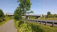
[171] In response, Montgomery County began the process of amending the ICC limited functional Master Plan to include the new design for the bike path in October of 2007.
[172] The amendment was approved in April 2009, and it proposed a bikeway near the Intercounty Connector as well as a plan that would divert bike traffic along New Hampshire Avenue, Route 29, East Randolph and Fairland roads.