Interstate 275 (Michigan)
The freeway runs through the western suburbs near Detroit Metropolitan Wayne County Airport, and crosses several rivers and rail lines in the area.
According to the Federal Highway Administration (FHWA), the length is 29.97 miles (48.23 km) because that agency considers I-275 to end at the junction with I-96 and M-14 along the boundary between Livonia and Plymouth Township.
The surrounding area is farmland and residential subdivisions in the adjacent Frenchtown and Berlin charter townships near the community of Newport.
[4][5][6] In the city of Romulus, I-275 begins to take on a more suburban character when it passes the southwestern boundary of the Detroit Metropolitan Wayne County Airport.
South of I-94,[4][7] the highway crosses over the same CSX line and a Norfolk Southern Railway (NS) line[6] and north of I-94, it passes a campus of Wayne County Community College and the headquarters of the Visteon Corporation,[4][7] a major auto parts supplier spun off from Ford Motor Company.
[4][7] The freeway crosses over another railroad line also used by Amtrak trains from Chicago and Pontiac,[6] US 12 (Michigan Avenue) and M-153 (Ford Road) in Canton.
[6] North of the Middle Branch of the River Rouge in Plymouth Township, I-275 crosses Schoolcraft Road and another CSX line from Detroit.
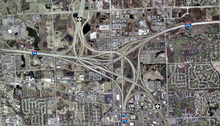
[6][7] The interchange with I-96 (Jeffries Freeway) on the border between Plymouth Township and Livonia is where the FHWA considers I-275 to end as they do not note any overlap with I-96,[2] however MDOT continues the designation on maps and signage to run concurrently with I-96 northward.
North of the interchange with the Jeffries Freeway, the combined I-96/I-275 curves to the east into Livonia, running parallel to Haggerty Road and continuing through suburban areas.
I-96/I-275 passes through an interchange with 8 Mile Road while crossing into Oakland County and entering the southwest corner of Farmington Hills.
[15] The first four miles (6.4 km) of the freeway were shown opened to traffic from M-153 (Ford Road) in Canton to Schoolcraft Avenue (just south of the I-96 and M-14 interchange) in Plymouth Township by the start of 1975.
Then on January 14, 1977, the remaining 23-mile (37 km) section of I-275 between US 24 in Monroe County and M-153 in Canton Township was opened to traffic, completing the current freeway.
[18] At the end of the 1970s, MDOT took part in a FHWA-backed initiative called the Positive Guidance Demonstration Project, and the two agencies audited signage practices in the vicinity of the I-96/M-37 and I-296/US 131 interchange in Walker near Grand Rapids.
[19] FHWA agreed with the department's proposal to eliminate all signage and public map references to the designation in April 1979.
They approached the department's Trunkline Numbering Committee and the district traffic and safety engineers on October 19, 1982, for proposals to reduce or eliminate the various overlapping designations to "avoid driver confusion and save funds".
[29] This parkway concept allowed at-grade intersections that would have not been permitted had the highway been built as a full freeway, and it included more landscaping and less grade separation.
The state increased MDOT's budget by $602 million (equivalent to $1.55 billion in 2023[17]), but left the M-275 project off a priority list.
[33] The Southeast Michigan Council of Governments (SEMCOG) continued to factor M-275 into regional transportation planning forecasts.
[34] Transportation planners at an April 24, 1985, meeting of the West Bloomfield Republicans said that the highway extension "would make sense" but MDOT "is planning no new freeways and no major road construction" at the time.
By the next month, MDOT had relinquished ownership of right-of-way in West Bloomfield Township, ending any further progress at building the roadway.
[27] Studies comparing the levels of traffic at various checkpoints along the existing I-275 showed that the freeway was only handling half of its rated capacity.
[14] After many years of inactivity, further work began along this same route to relieve traffic congestion in the area,[35] but the resulting highway was designated as a part of M-5 rather than I-275 or M-275.