Interstate 65 in Indiana
The Indiana portion of I-65 begins in Jeffersonville after crossing the Ohio River and travels mainly north, passing just west of Columbus prior to reaching the Indianapolis metro area.
Upon reaching Indianapolis, the route alignment of I-65 begins to run more to the northwest and subsequently passes Lafayette on that city's east and north sides.
[2] As part of that reconstruction, the old ramps were replaced with ones that eliminate the lane switching that drivers originally had to perform to stay on I-70 eastbound and I-65 northbound.
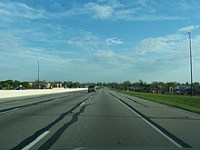
At milemarker 116, I-65 passes Crown Hill Cemetery, burial site and memorial of former-President Benjamin Harrison.
The Indiana Department of Transportation (INDOT) marked change in timezone with a two-sided blue sign in the center median.
[6][7] The 13.39-mile (21.55 km) stretch between a temporary connection with US 52 near Royalton in Boone County (just south of the present-day interchange with I-865) and the US 52 junction northwest of Lebanon opened in December 1960.
The initial southern Indiana portion, running 45.71 miles (73.56 km) between then-US 31E (now US 31) in Clarksville and US 50 east of Seymour, saw its first traffic in November 1961.
[5] However, the final three segments from the south side through the heart of the city, including the common portion of I-65 and I-70 (east leg of the "Inner Belt"), were not finished and opened to traffic until October 1976.
[citation needed] As part of the Operation Indy Commute project, INDOT began work in 2013 to widen I-65 on both northbound and southbound mainlines from exit 103 at Southport Road northward to the southern junction with I-465 (exit 106), adding auxiliary lanes in this section to improve merging of traffic entering southbound I-65 from I-465 and entering northbound I-65 from westbound Southport Road.