Interstate 90 in Minnesota
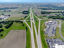
This part of Minnesota has flat to gently rolling terrain and is the beginnings of Corn Belt farmland.
The flat terrain is often subject to blowing and drifting snow in colder months, and the western portions of the highway are closed multiple times each winter.
East of the city of Austin, I-90 changes direction slightly and heads toward Rochester, and the route enters a much more hilly landscape.
I-90 is atypical in that, just across the Minnesota–Wisconsin state line, (immediately west of the community of Dakota) the median is wide enough that farms exist between the road beds.
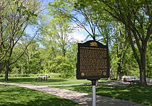
[4] The wayside rest area near Blue Earth is where the east-building I-90 and west-building I-90 teams linked up in 1978, thus completing construction in Minnesota and joining the 3,099.07 miles (4,987.47 km) of the Interstate.
[6] Since being overlaid with bituminous paving in 2006,[7] the original four-foot-wide (1.2 m) gold-colored cement concert line marking the completion of I-90 has been replaced with gold paint on just the shoulder portions of the roadway at the same location.