Journey planner
In the late 1980s and early 1990s, some national railway operators and major metropolitan transit authorities developed their own specialized trip planners to support their customer enquiry services.
The first digital public transport trip planner systems for a microcomputer was developed by Eduard Tulp, an informatica student at the Amsterdam University on an Atari PC.
In 1990 the first digital trip planner for the Dutch Railways (on diskette) was sold to be installed on PC's and computers for off-line consultation.
[8] The principles of his software program was published in a Dutch university paper in 1991[9] This was soon expanded to include all public transport in the Netherlands.
The world's first mobile trip planner for a large metropolitan area, a WAP based interface to the London using the Mentz engine, was launched in 2001 by London startup company Kizoom Ltd, who also launched the UK's first rail trip planner for the mobile internet in 2000, also as a WAP service, followed by an SMS service.
Starting in 2000 the Traveline[13] service provided all parts of the UK with regional multi-modal trip planning on bus, coach, and rail.
Internet trip planners now constitute a primary sales channel for most rail and air transport operators.
The successful uptake of GTFS as an available output format by large operators in many countries has allowed Google to extend its trip planner coverage to many more regions around the world.
Also significant has been the integration of other types of data into the trip planning results such as disruption notices, crowding levels, CO2 costs, etc.
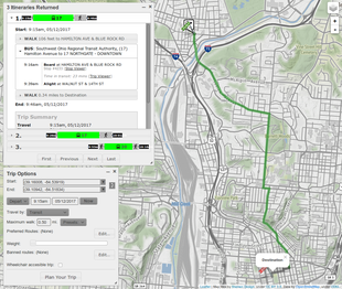
The application prompts a user to input an origin and a destination, and then uses algorithms to find a good route between the two on public transit services.
A journey planner will ideally provide detailed routing for pedestrian access to stops, stations, points of interest etc.
These systems assume, or allow the user to specify, preferences for quiet or safe roads, minimal elevation change, bicycle lanes, etc.
Passengers don't travel because they want to go to a particular station or stop, but because they want to go some destination of interest, such as a sports arena, tourist attraction, shopping center, park, law court, etc., etc.
Many trip planners allow users to look for such "Points of interest", either by name or by category (museum, stadium, prison, etc.).
Major operators such as Transport for London or National Rail have historically had well developed sets of such data for use in their Customer Call centers, along with information on the links to the nearest stops.
For points of interest that cover a large area, such as parks, country houses or stadia, a precise geocoding of the entrances is important.
They use two main types of feed to do this, obtained from road data services using interfaces such as Datex II or UTMC.
In the European Union all public passenger travel operators have the obligation to provide the information under the EU railway timetable data exchange format.
The CEN NeTEx format allows both the physical layer (e.g. road and railway track infrastructure links) and the logical layer (e.g. links between scheduled stopping points on a given line) of the transport infrastructure to be exchanged In the UK the Online Journey Planner (OJP) is the engine used by National Rail to plan routes, calculate fares and establish ticket availability.
Data on public transport schedules is used by trip planners to determine the available journeys at specific times.
[1] Trip planners may be able to incorporate real-time information into their database and consider them in the selection of optimal routes for travel in the immediate future.
A trip planner will typically use a standard interface such as SIRI, TPEG or Datex II to obtain situation information.
Typically journey planners use an efficient in-memory representation of the network and timetable to allow the rapid searching of a large number of paths.
Real-world implementations involve a tradeoff of computational resources between accuracy, completeness of the answer, and the time required for calculation.
[4] The sub-problem of route planning is an easier problem to solve[28] as it generally involves less data and fewer constraints.
When time-dependent features such as public transit are included, there are several proposed ways of representing the transport network as a graph and different algorithms may be used such as RAPTOR[30] Automated trip planners generate your itinerary automatically, based on the information you provide.
Another way is to provide the necessary information by forwarding confirmation e-mails from airlines, hotels and car rental companies.
[31] With a custom trip planner the user creates one's own travel itinerary individually by picking the appropriate activities from a database.
[32] Custom trip planning startups are seeing renewed interest from investors with the advent of data science, AI and voice technologies in 2018.