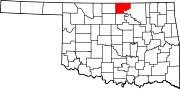
Kay County, Oklahoma
Kay County comprises the Ponca City micropolitan statistical area.
The remains of two large 18th-century villages, the Deer Creek/Bryson Paddock Sites, of Wichita Native Americans have been found overlooking the Arkansas River in Kay County.
In 1825, the Osage ceded to the U.S. government their rights to a large expanse of land, including Kay County, and the government gave the Cherokee ownership of the land after their migration to Oklahoma in the 1830s.
The Kansa (Kaw) arrived in June 1873, settling in what became the northeastern part of Kay County.
The Nez Perce came from the Pacific Northwest in 1879, but remained only until 1885, when they returned to their earlier homeland.
Their assigned land in Oklahoma was then occupied by the Tonkawa and Lipan Apache peoples.
Most of Kay County became open to non-Native American settlement in 1893 with the Cherokee Strip Land Run in which thousands of people rushed into Kay County to claim free land.
[6] [7] According to the U.S. Census Bureau, the county has a total area of 945 sq mi (2,450 km2), of which 25 square miles (65 km2) (2.7%) are covered by water.
[8] The highest point in Kay County, Oklahoma, is west of North Sage Lane (36′56″12°N, 96′53″40°W), at 1,310 feet (400 m) above sea level.
Kaw Lake, a large reservoir on the Arkansas River completed in 1975 includes most of the water area of the country.
[1] Of 3,142 counties in the United States in 2014, the Institute for Health Metrics and Evaluation ranked Kay County 2,441 in the average life expectancy at birth of male residents and 2,650 in the life expectancy of female residents.
[17] In 2020, the Robert Wood Johnson Foundation ranked Kay country as 47th of 77 counties in Oklahoma in "health outcomes," as measured by length and quality of life.