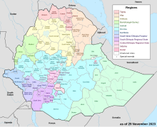
Keficho Shekicho Zone
A 1997 Situation Report by the United Nations Development Programme/Emergencies Unit for Ethiopia states that originally Kaffa and Sheka were separate zones, but were combined in early 1996.
Keficho Shekicho was bordered on the south by Debub Omo, on the southwest by Bench Maji, on the west and north by the Oromia Region, and on the east by Semien Omo.
The administrative center of Keficho Shekicho was Bonga; other towns included Tepi.
The CSA reported that 10,352 tons of coffee were produced in Keficho Shekicho in the year ending in 2005, based on inspection records from the Ethiopian Coffee and Tea authority.
[4] According to a May 24, 2004 World Bank memorandum, 2% of the inhabitants of Keficho Shekicho have access to electricity, this zone has a road density of 38.4 kilometers per 1000 square kilometers (compared to the national average of 30 kilometers),[5] the average rural household has 0.7 hectare of land (compared to the national average of 1.01 hectare of land and an average of 0.89 for the SNNPR)[6] the equivalent of 0.4 heads of livestock.

