Keltern
The oldest documentary records for the constituent towns of Keltern are from 827 or 830 for Dietenhausen, 919 for Ellmendingen, sometime in the 11th century for Dietlingen, 1219 for Weiler, and around 1300 for Niebelsbach.
[4] On 30 March 1972, all five townships were joined to form the municipality of Keltern, which was assigned to [de] the Enz district on 1 January 1973.
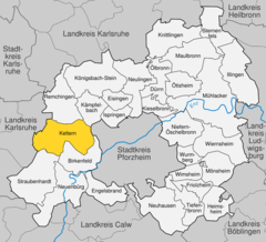
[4] The municipality (Gemeinde) of Keltern covers an area of 29.83 square kilometers (11.52 sq mi) in the Enz district, within the state of Baden-Württemberg and Federal Republic of Germany.
Keltern's primary watercourse is the Pfinz river, whose eastern tributaries flow in a rift parallel to the Upper Rhine Plain.
[4] Population development:[5] Keltern's coat of arms was approved by the Federal Ministry of the Interior on 11 July 1973 and generally recalls the viticulture practiced in the municipal area since the 15th century.