Kosi River
The Saptakoshi crosses into northern Bihar, India where it branches into distributaries before joining the Ganges near Kursela in Katihar district.
[3][4] In the past, several authors proposed that the river has shifted its course by more than 133 km (83 mi) from east to west during the last 200 years.
The river is joined by major tributaries in the Mahabharat Range approximately 48 km (30 mi) north of the Indo-Nepal border.
Below the Siwaliks, the river has built up a megafan some 15,000 km2 (5,800 sq mi) in extent, breaking into more than 12 distinct channels, all with shifting courses due to flooding.
[15] The reason for such a large, deep gorge is that the river is antecedent to the Himalayas, meaning that it had existed before them and has entrenched itself since they started rising.
Peaks located in the basin include Mount Everest, Kangchenjunga, Lhotse, Makalu, Cho Oyu and Shishapangma.
[17] The Kosi River is known as the "Sorrow of Bihar" as the annual floods affect about 21,000 km2 (8,100 sq mi) of fertile agricultural lands thereby disturbing the rural economy.
[18] On 18 August 2008, the Kosi River picked up an old channel it had abandoned over 100 years previously near the border with Nepal and India.
[22] The Government of Bihar convened a technical committee, headed by a retired engineer-in-chief of the water resource department to supervise the restoration work and close the breach in the East Kosi afflux embankment.
[22] Indian authorities worked to prevent widening of the breach, and channels were to be dug to direct the water back to the main river bed.
[23] The fury of the Kosi River left at least 2.5 million people marooned in eight districts and inundated 400 sq mi (1,000 km2).
[29] An inundation canal taking off at Chatra, where the Kosi River debouches into the plains, has been built to irrigate a gross area of 860 km2 in Nepal.
Embankments on both sides downstream of the barrage with a length of 246 km (153 mi) were constructed to check the westward movement of the river.
[26] The governments of India and Nepal agreed to conduct joint investigations and other studies for the preparation of a detailed project report of Sapta Koshi High Dam Multipurpose Project and Sun Koshi Storage-cum-Diversion Scheme to meet the objectives of both countries for development of hydropower, irrigation, flood control and management and navigation.
Extra storage capacity of Sapta Koshi High Dam would be provided to moderate downstream flooding.
The economically exploitable potential is assessed as 10,860 MW (includes the Sapta Koshi Multipurpose Project [3300MW] mentioned above).
It is mentioned in the Bal Kand section of Valmiki Ramayana as the Kausiki who is the form assumed by Satyavati after her death.
Due to the violent nature of the Kosi during monsoon season, legend says that Parvati, the wife of Shiva, after defeating the demon Durg, became known as the warrior goddess Durga who transformed into Kaushiki.
According to Mahabharata epic, the God of death took the form of a woman and resides on the banks of the river to limit population growth.
These images capture the contradiction that is inherent in the Kosi River as a source of life and death, prosperity and destruction; a mother and an enchanting virgin.
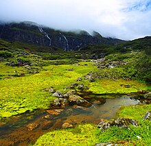
The landscape in the park is rugged consisting of mountain peaks, glaciers, rivers, lakes, forests, alpine scrubs and meadows.
[35] The Koshi Tappu Wildlife Reserve is situated in the flood plains of the Saptkoshi River in the eastern Terai.
[34] The last surviving population of wild water buffalo in Nepal is found in the reserve, as well as Gangetic dolphin, swamp francolin and rufous-vented prinia.