Lake St. Clair
It has a total surface area of about 430 square miles (1,100 km2) and an average depth of just 11 feet (3.4 m); to ensure an uninterrupted waterway, government agencies in both countries have maintained a 30-foot-deep (9.1 m) shipping channel through the shallow lake for more than a century.
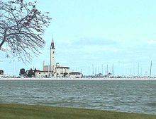
This lake is situated about six miles (10 km) northeast of the downtown areas of Detroit, Michigan, and Windsor, Ontario.
However, it is 27 feet (8.2 m) deep in the navigation channel which is dredged for lake freighter passage by the U.S. Army Corps of Engineers.
[1][2] Scattered proposals have called for it to be officially recognized as a Great Lake, which might enable it to attract greater public funding for scientific research and other projects.
The French expressed this association on their maps as Mer Douce (sweet sea) and the Dutch identified it in Latin as Mare Dulce.
[6] On August 12, 1679, the French explorer René Robert Cavelier, Sieur de La Salle arrived with an expedition.
He named the body of water Lac Sainte-Claire, as the expedition sighted it on the feast day of Saint Clare of Assisi.
[9] Unlike most smaller lakes in the region—but like the Great Lakes—Lake comes at the front of its proper name, rather than the end; this is reflective of its French origins.
The Crawford Knoll Site located on the eastern branch of the St. Clair River delta uncovered bone and projectile points dating back to 1500 to 1000 BCE which suggest seasonal usage by the local Indigenous population.
The governments on both sides of the lakes continue to monitor and publish guides for sport fish consumption.