St. Clair River
Generations of indigenous cultures traveled by canoe on the lakes and rivers in this area, carrying on trade across the region and continent.
In the 18th century, French voyageurs and coureurs des bois traveled on the river to trade with the Ojibwa and other regional Native Americans and transport furs in canoes to major posts of French and British traders, including Fort Detroit, built in 1701 downriver from Lake St. Clair on the Detroit River.
Lumber harvested on The Thumb of Michigan was shipped downriver as log rafts to Detroit for processing and export both domestically and internationally.
In Michigan, the Black, Pine, and Belle rivers drain 780,600 acres (315,900 ha) in Lapeer, Macomb, Sanilac, and St. Clair counties; the watersheds around Bunce Creek and Marine City are relatively small.
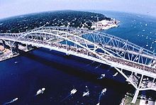
Intensive development has occurred in and near the adjacent cities of Port Huron, Michigan and Sarnia, Ontario, at the northern end of the river.
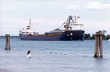
The most dense concentration of industry, including a large petrochemical complex, lies along the Ontario shore south of Sarnia.
Land areas of the St. Clair River shoreline and flats consist of two biological zones: upland and transitional, both of which are normally above the water table, but which may be flooded periodically.
Transitional species are abundant in the low-lying regions, categorized as shrub ecotones, wet meadows, sedge marshes, and island shorelines and beaches.
This habitat is home to water and land mammals, including humans, as well as songbirds, waterfowl, insects, pollinators, reptiles, and amphibians.
The St. Clair River has been considered an AOC because conventional pollutants such as bacteria, heavy metals, toxic organics, contaminated sediment, fish consumption advisories, impacted animal and plant life, and beach closings.
Its background report noted the adverse effects of pollution in the river and lakes: According to the Stage 1 Remedial Action Plan (RAP), the reasons for the Loss of Fish and Wildlife Habitat beneficial use impairment (BUI) in the St. Clair River were general loss of the aquatic plant community due to industrial, agricultural, recreational, and urban developments.
A large blob of perchloroethylene was found at the bottom of the St Clair River due to runoff from Dow Chemical Corp in 1985.
Federal officials have long acknowledged that dredging and riverbed mining in the St. Clair dropped the long-term average of Great Lakes Huron and Michigan by about 16 inches.