Land reclamation in the Netherlands
The Dutch people inhabiting the region had at first built primitive dikes to protect their settlements from the sea.
[1] In the northern parts of the Netherlands sea levels fell exposing new land at a rate of 5–10 meters per year between 500 BC and 500 AD.
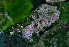
[5] In 2012, plans emerged to create the Marker Wadden,[6] a group of islands designed to establish nature reserves in the north of the Markermeer.
About half the total surface area of polders in north-west Europe is in the Netherlands.
Water boards hold separate elections, levy taxes, and function independently from other government bodies.
The 1953 flood disaster prompted a new approach to the design of dikes and other water-retaining structures, based on an acceptable probability of overflowing.
The particular established policy guides the Dutch government to improve flood defences as new data on threat levels becomes available.
In the late 1970s, the project was revised down leaving wide bordering lakes between the polder and North Holland.
[12] In the 1960s, the Vereniging tot Behoud van de Waddenzee organization successfully campaigned against plans to reclaim part of the Wadden Sea.
[13] In 1974, the Association for the Preservation of the IJssel Lake (also known as the Vereniging tot Behoud van het IJsselmeer), one of the most vocal groups against land reclamation, published Plan Waterlely, which provided opposing viewpoints and solutions to land reclamation.
[13] The Plan also argued that urbanization would lead to more land reclamation, which would create a never ending cycle of reclamation, and that creating newly reclaimed land would only delay the fixing of the core issues of urbanization.