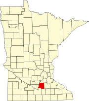
Le Sueur County, Minnesota
[4] Le Sueur County is part of the Minneapolis-St. Paul-Bloomington, MN-WI Metropolitan Statistical Area.
It was named for French explorer Pierre-Charles Le Sueur, who visited the area in 1700.
However, its remoteness from most of the county meant hardship for most of the area's residents since the county was covered with dense hardwood forest and existing roads were impassable when wet.
The referendum passed, but was challenged due to voting irregularities.
[6] In the 1870s, businessmen from Waterville gained ownership of a quarter-section of land near the county's center, cleared the timber, and platted the city of Le Sueur Center (1876).
[7]The Minnesota River flows northeastward along the west border of Le Sueur County, on its way to discharge into the Mississippi.
The terrain consists of low rolling hills, dotted with lakes and ponds.
23.70% of all households were made up of individuals, and 10.90% had someone living alone who was 65 years of age or older.
In 78% of national elections since 1980, the county selected the Republican Party candidate (as of 2020).