Lincoln Heights, Spokane
As the name suggests, Lincoln Heights lies on the slopes and atop the crest of the South Hill area.
The Lincoln Heights Shopping Center and surrounding area is one of the largest and most important commercial and retail districts on the entire south side of Spokane.
In 1885, what is now Lincoln Heights was connected with the then burgeoning city of Spokane via a county road laid along the route of 29th Avenue.
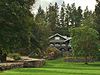
[2] As part of their plan for the layout of the city in 1908, the Olmsted Brothers recommended establishing a large park in the north of the neighborhood.
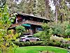
After an initial surge in purchases in the Lincoln Heights Addition, construction slowed, and the neighborhood retained a mixed rural and urban character through the early decades of the 20th century.
[2] The neighborhood's dual rural and urban character in the first half of the 20th century faded away as infill developments took place in the 1970s and 1980s.
All five are located in the older, lower part of the neighborhood which is closer to the city center than the higher, newer areas of Lincoln Heights to the south and east.
In places, like in Lincoln Park, the slope is so steep that it exists as vertical faces of exposed Columbia River Basalt Group rock cliffs.
Along the northern edge of Lincoln Heights runs the Ben Burr Trail connecting Liberty and Underhill Parks in neighboring East Central.
A grassy and tree-lined parkway runs down the middle of 35th Avenue from Regal Street in the center of the neighborhood to the city limits on the east.
However, along the ridge that runs through the middle of the neighborhood, and on the rocky slopes along the north, streets are forced to wind their way through the local terrain.
A few square blocks in the far northwest corner of the neighborhood are part of the Grant Elementary district, located in neighboring East Central.
[12] Franklin and Lincoln Heights feed into Chase Middle School, located in the far southeastern corner of the neighborhood at 37th Avenue.
[2] 29th Avenue passes through the heart of Lincoln Heights as it traverses the entire South Hill from east to west.
Ray Street, running north-south through the eastern half of Lincoln Heights, is designated as a principal arterial as well.
[14] For cyclists, a dedicated bicycle lane exists along the length of Southeast Boulevard through Lincoln Heights and along 37th Avenue east of Regal Street.