List of Category 3 Pacific hurricanes
Furthermore, from January to April, the North Pacific High and Aleutian Low induce strong vertical wind shear and unfavorable conditions that serve to prevent the development of hurricanes.
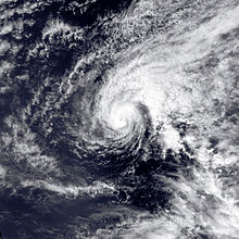
On the Saffir–Simpson scale, a hurricane reaches Category 3 status when it attains maximum sustained winds of between 96 and 112 knots (110 and 129 mph; 178 and 207 km/h; 49 and 58 m/s).
[10] During the winter and spring months of December to April, sea surface temperatures in the tropics are usually too low to support development.
Another factor preventing tropical cyclones from forming during the winter is the presence of a semi-permanent low-pressure area called the Aleutian Low between January and April.
Its effects in the central Pacific near the 160th meridian west cause tropical waves that form in the area to drift northward into the Gulf of Alaska and dissipate or become extratropical.
Its retreat in late-April allows the warmth of the Pacific High to meander in, bringing its powerful clockwise wind circulation with it.
The Intertropical Convergence Zone departs southward in mid-May permitting the formation of the earliest tropical waves,[11] coinciding with the start of the eastern Pacific hurricane season on May 15.
[9] During summer and autumn, sea surface temperatures rise further to reach near 29 °C (84 °F) in July and August, well above the 26.5 °C (79.7 °F) threshold for tropical cyclogenesis.
[11] The El Niño-Southern Oscillation also influences the frequency and intensity of hurricanes in the Northeast Pacific basin.
[12] Contrary to El Niño, La Niña increases wind shear and decreases sea surface temperatures over the eastern Pacific, while reducing wind shear and increasing sea surface temperatures over the Atlantic.