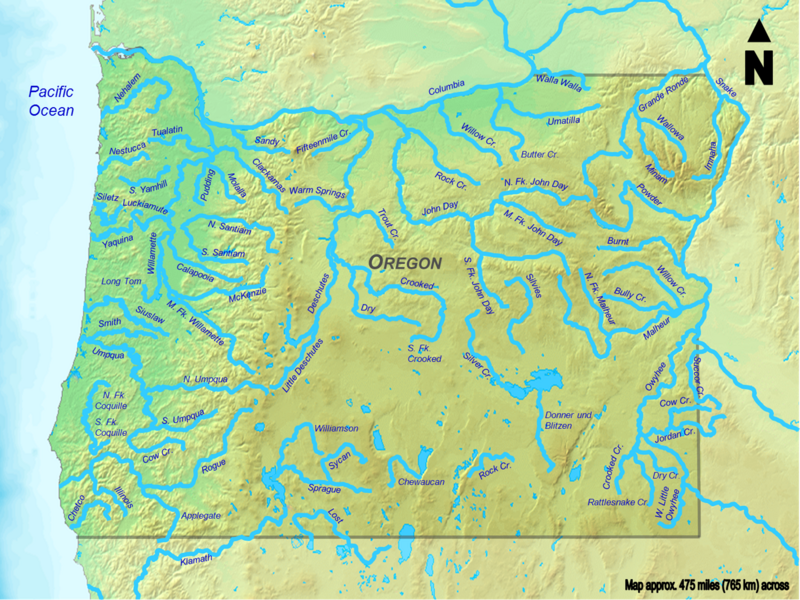
List of longest streams of Oregon

The Atlas of Oregon ranks 31 rivers in the state by average streamflow; the top five are the Columbia, Snake, Willamette, Santiam, and Umpqua.

[1] Not all Oregon rivers with high average flows are on this list of longest streams because neither their main stems nor any of their tributaries (including what are called "forks") are at least 50 miles (80 km) long.

A third set, including the Klamath River and its tributaries, originates in Oregon, but its waters eventually flow into northern California before reaching the ocean.

Other streams like the Donner und Blitzen River flow into closed basins, such as Malheur Lake, that have no outlet to the sea.

[1] Source data for the table below came from topographic maps created by the United States Geological Survey and published on-line by TopoQuest,[2] and from the Atlas of Oregon;[1] the Oregon Atlas and Gazetteer;[3] two federally produced geographic information system (GIS) datasets—the National Hydrography Dataset and the National Watershed Boundary Dataset—and other sources as noted.

A wide placid river flows through the woods.
Rogue River (seventh longest) near Indian Mary Park in Josephine County
Clickable map of all Oregon streams more than 50 miles (80 kilometers) long Applegate River Bully Creek Burnt River Butter Creek Calapooia River Chetco River Chewaucan River Clackamas River Columbia River Cow Creek Cow Creek Crooked Creek Crooked River Deschutes River Donner und Blitzen River Dry Creek Dry River Fifteenmile Creek Grande Ronde River Illinois River Imnaha River John Day River Jordan Creek Klamath River Little Deschutes River Long Tom River Lost River Luckiamute River Malheur River McKenzie River Middle Fork John Day River Middle Fork Willamette River Minam River Molalla River Nehalem River Nestucca River North Fork Coquille River North Fork John Day River North Fork Malheur River North Santiam River North Umpqua River Owyhee River Powder River Pudding River Rattlesnake Creek Rock Creek Rock Creek Rogue River Sandy River Siletz River Silver Creek Silvies River Siuslaw River Smith River Snake River South Fork Coquille River South Fork Crooked River South Fork John Day River South Santiam River South Umpqua River South Yamhill River Sprague River Succor Creek Sycan River Trout Creek Tualatin River Umatilla River Umpqua River Walla Walla River Wallowa River Warm Springs River West Little Owyhee River Willamette River Williamson River Willow Creek Willow Creek Yaquina River Pacific Ocean Oregon
Image map of all Oregon streams more than 50 miles (80 kilometers) long. Each label is wikilinked to an article. Click on the small rectangles to the right of the caption for a larger map.