Rogue River (Oregon)
The Rogue River (Tolowa: yan-shuu-chit’ taa-ghii~-li~’,[8] Takelma: tak-elam[9]) in southwestern Oregon in the United States flows about 215 miles (346 km) in a generally westward direction from the Cascade Range to the Pacific Ocean.
The Rogue River begins at Boundary Springs on the border between Klamath and Douglas counties near the northern edge of Crater Lake National Park.
Although it changes direction many times, it flows generally west for 215 miles (346 km) from the Cascade Range through the Rogue River – Siskiyou National Forest and the Klamath Mountains to the Pacific Ocean at Gold Beach.
[20] In 2000, Jackson County had a population of about 181,300, most of them living in the Rogue River Valley cities of Ashland (19,500), Talent (5,600), Phoenix (4,100), Medford (63,200), Central Point (12,500), and Jacksonville (2,200).
[24] At high elevations in the Cascades, much of the precipitation arrives as snow and infiltrates permeable volcanic soils; snowmelt contributes to stream flows in the upper basin during the dry months.
[24] The High Cascades are composed of volcanic rock produced at intervals from about 7.6 million years ago through geologically recent events such as the catastrophic eruption of Mount Mazama in about 5700 BCE.
The Klamath Mountains consist of multiple terranes—former volcanic islands and coral reefs and bits of subduction zones, mantle, and seafloor—that merged offshore over vast stretches of time before colliding with North America as a single block about 150 to 130 million years ago.
This three- to five-million-year episode of intense tectonic activity pushed sedimentary rocks deep enough into the mantle to melt them and then forced them to the surface as granitic plutons.
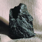
[27] At the mouth of the Rogue River, along the coast of Curry County, is the Otter Point Formation, a mélange of metamorphosed sedimentary rocks such as shales, sandstones, and chert.
[27] In 2018, a geologist from the University of Oregon found a toe bone of a plant-eating dinosaur near Mitchell in the east-central part of the state where the coast lay 100 million years ago.
[33] People left the villages during about half of the year to gather camas bulbs, sugar-pine bark, acorns, and berries, and hunted deer and elk to supplement their main food, salmon.
[36] In 1827, an HBC expedition led by Peter Skene Ogden made the first direct contact between whites and the inland Rogue River natives when he crossed the Siskiyou Mountains to look for beaver.
[39] Later called the Applegate Trail, it passed through the Rogue and Bear Creek valleys and crossed the Cascade Range between Ashland and south of Upper Klamath Lake.
[47] John P. Gaines, the new territorial governor, negotiated a new treaty with some but not all of the Indian bands, removing them from Bear Creek and other tributaries on the south side of the main stem.
[49] As the white population increased and Indian losses of land, food sources, and personal safety mounted, bouts of violence upstream and down continued through 1854–55, culminating in the Rogue River War of 1855–56.
These pioneers, some of whom were white gold miners married to native Karok women from the Klamath River basin, established gardens and orchards, kept horses, cows, and other livestock, and received occasional shipments of goods sent by pack mule over the mountains.
In 1883, one of the settlers, Elijah H. Price, proposed a permanent mail route by boat up the Rogue River from Ellensburg (later renamed Gold Beach) to Big Bend, about 40 miles (64 km) upstream.
Price's job, for which he received no pay during the trial year, included running the post office and making sure that the mail boat made one round trip a week.
[59] Propelled by rowing, poling, pushing, pulling, and sometimes by sail, the mail boat delivered letters and small packages, including groceries from Wedderburn, where a post office was established later in 1895.
[38] By the 1880s, Robert Deniston Hume of Astoria had bought land on both sides of the lower Rogue River and established such a big fishing business that he became known as the Salmon King of Oregon.
Famous visitors included actors Clark Gable, Tyrone Power and Myrna Loy, singer Bing Crosby, author William Faulkner, journalist Ernie Pyle, radio comedians Freeman Gosden and Charles Correll, circus performer Emmett Kelly, and football star Norm van Brocklin.
[84] From 1940 to 1990, actress and dancer Ginger Rogers owned the 1,000-acre (400 ha) Rogue River Ranch, operated for many years as a dairy farm, near Eagle Point.
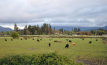
[85] Actress Kim Novak and her veterinarian husband bought a home and 43 acres (17 ha) of land in 1997 near the Rogue River in Sams Valley, where they raise horses and llamas.
Built in pieces between 1911 and 1944, it includes separate diversion dams on the Middle Fork Rogue River and Red Blanket Creek, and a 9.25-mile (14.89 km) water-transport system of canals, flumes, pipes, and penstocks.
[111][n 4] The Oregon 303(d) list of pollutants for 2004–06 indicated that some reaches of the surface waters in the Rogue River basin did not meet the standards for temperature, bacteria, dissolved oxygen, sedimentation, pH and nuisance weeds and algae.
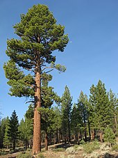
[24] The Klamath-Siskiyou region is one of seven International Union for Conservation of Nature (IUCN) areas of global botanical significance in North America and has been proposed as a World Heritage Site and UNESCO Biosphere Reserve.
To enter it, boaters must obtain a special-use permit allocated through a random-selection process and pick it up at the Smullin Visitor Center, about 20 miles (32 km) west of Interstate 5 on the Merlin–Galice Road, at the Rand Ranger Station downstream of Galice.
The river between Grants Pass and Grave Creek has productive runs of summer and winter steelhead and Chinook, as well as good places to fish for trout.
From Grave Creek to Foster Bar, all but the lower 15 miles (24 km) of which is closed to jetboats, anglers fish for summer and winter steelhead, spring and fall Chinook, and Coho.
[130] TouVelle State Recreation Site is a day-use park along the river at the base of Table Rocks and adjacent to the Denman Wildlife Area, about 9 miles (14 km) north of Medford.