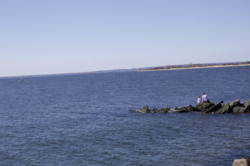
Lower New York Bay
The eastern end of the Bay is marked by two spits of land, Sandy Hook, New Jersey, and Rockaway, Queens.
The waterway between the spits connects the Bay to the Atlantic Ocean at the New York Bight.
Since before the time of the Lenape, the Native American inhabitants of the area, the Lower Bay has sustained a rich marine ecosystem with multiple fish species and molluscs, especially oyster, clam and mussel beds.
In the 20th century, due to increased population and industrial pollution, the water quality of the bay and its ability to support marine life was severely diminished.
The other major use for the two islands during World War II were as anchorages for antisubmarine nets that fenced off New York Bay from the Atlantic Ocean to keep enemy submarines out.