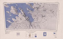
Mackay Mountains
The highest summit, 1,155 metres (3,789 ft) high, in the Mackay Mountains, situated 1.5 nautical miles (2.8 km; 1.7 mi) northeast of Vivian Nunatak in the southwest part of the group.
Mapped by USAS (1939–41) and by USGS from surveys and United States Navy air photos (1959-65) Named by US-ACAN for Lieutenant Laurence C. Monson III, United States Navy Reserve, co-pilot of LC-130F Hercules aircraft during Operation Deep Freeze 1968.
Mapped by USAS (1939–41) and by USGS from surveys and United States Navy air photos (1959-65).
Named by US-ACAN for Lieutenant Robert A. Palombo, United States Navy, aircraft commander during Operation Deep Freeze 1968.
An isolated nunatak, 10 nautical miles (19 km; 12 mi) high, southeast of the Mackay Mountains.