Mainland Australia
Over the next 6,000[10] years the ice gradually melted, increasing sea-levels, cutting off Papua New Guinea and Tasmania from mainland Australia.
Although an exact figure has not been decided on, numerous DNA studies all confirm that Aboriginal Australians are one of the oldest living populations in the world[12] outside of Africa.
Currently, Indigenous people living on the mainland make up 2.4%[13] of the total Australian population, encompassing over 250 language groups.
[14] The first documented encounter of the Australian mainland was by Willem Janszoon in 1606, as he sailed around Australia's north coast arriving in present-day Cape York, Queensland.
[16] This encounter led several other Dutch, Spanish, Portuguese and British journeyings to Terra Australis throughout the 17th and 18th century, progressively mapping what we now know to be as (mainland) Australia.
The most famous and well documented expedition of Australia occurred 164 years after Janszoon's journey, through British navigator and explorer James Cook.
This journey, coupled with numerous other reports, ultimately led the British to establish a penal colony in Australia, firstly at Botany Bay.
[19] These physical changes developed four primary landform divisions spread throughout the mainland states and territories; the Coastal Plains, the Eastern and Southern highlands, the Central Lowlands (and Deserts) and the Western and Northern Plateaus (and Basins).
Along the Eastern seaboard of the mainland are the Coastal Plains; a narrow strip of land along the East coast of Australia from Queensland to Victoria.
[20] This division is host to some of the mainland's major cities, namely, Brisbane, Sydney and Melbourne, due to its hospitable conditions.
[19] Approximately 100 km (62 mi) inland, the Eastern Highlands (including the Great Dividing Range) cover almost 10% of the mainland.
[21] Incorporating several mountain ranges which extend 3,700 km (2,300 mi)[22] the Highlands run parallel to the east coast of the mainland; covering Queensland, New South Wales, the Australian Capital Territory and Victoria.
Occupying approximately 25% of the Australian mainland,[21] the Central Lowlands (and Deserts) are low-lying with an average height of under 200 metres (660 ft) above sea level.
[24] Approximately 144 to 65 million years ago (Cretaceous period), there lay a great inland sea, stretching over one quarter of the mainland.
Australia's separation from the other continents resulted in a long period of uplift, erosion and thick terrigenous deposition in rift valleys.
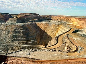
However, on the mainland, the abundance of minerals (and thus metals) has formed the basis of Australia's dependence on mining;[26] exporting much of these natural occurring resources overseas.
Australian political decisions are typically deliberated and enacted within the limits of homeland (mainland Australia) soil.