March 2023 North American winter storm
A winter storm in March 2023 impacted much of the Western, Northern, and Northeastern United States, producing high snowfall totals and widespread damage across the region.
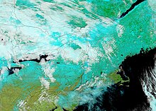
The winter storm, unofficially named Winter Storm Sage by The Weather Channel, first progressed across the Western United States as an atmospheric river, and then moved across the northern United States, bringing blizzard conditions and moderate snowfall across the Northern U.S.[2] The winter storm then became a nor'easter and impacted the Northeast, bringing snowfall rates of 1–2 inches (2.5–5.1 cm) per hour across numerous locations across the Northeast and 3 feet (36 in) of snow in several locations across the region with locally higher amounts.
Readsboro, Vermont received 42.1 inches (107 cm) of snow,[4] and nearly 200 car accidents occurred across the New England region in the Northeast.
[5] As a result, an atmospheric river developed, bringing heavy rainfall and high snow accumulations to portions of the Western United States and Sierra Nevada.
[2] The winter storm then became a nor'easter as another low-pressure area developed off the Carolina coast and moved northward along the coastline of the Northeastern United States, bringing snowfall rates of 1–2 inches (2.5–5.1 cm) per hour across numerous locations across the Northeast for the next several days.
[3] The winter storm brought 3 feet (36 in) of snow in some locations across the Northeastern United States, with locally higher amounts.
[12] Connecticut Governor Ned Lamont banned all tractor-trailers on Interstate 84 in the early morning hours on March 14 in preparation for the storm.
[15] Prior to the winter storm, Jon Palmer of the National Weather Service office in Gray, Maine, stated that the precipitation may cause significant power disruptions that last for over 48 hours.
[29] The heavy snowfall across the Sierra Nevada mountain range led to collapsed roofs across South Lake Tahoe.
[11] The town of Mount Charleston received 1.38 inches (35 mm) of rain, and the visitor center at the Red Rock Canyon National Conservation Area recorded a 52 miles per hour (84 km/h) wind gust.
[32] On March 11, blizzard conditions occurred across portions of the state, which forced closures on Interstate 94 between Jamestown and Dickinson, as well as on U.S. Route 52.
[39] In Minnesota, high snowfall totals were observed across northern portions of the state, with a weather station recording 18.5 inches (47 cm) west of Two Harbors.
[43] During the storm, 284,000 customers lost power across the Northeast,[44] and low visibility led to over 200 car crashes in New England.
[15] More than 73,000 power outages occurred across the state,[44] and a 66 miles per hour (106 km/h) wind gust was recorded at Mount Washington Observatory.
[44] Heavy rain fell throughout the New York metropolitan area, accumulating up to 4.12 inches (105 mm) of rainfall in Higganum, Connecticut.
[62] More than 12,000 customers lost power in Pennsylvania as snow fell across western and northeastern portions of the state, including the Pittsburgh and Scranton areas.