Maribyrnong River
Formed by the confluence of the Jackson Creek and the Deep Creek below Taylors Lakes, the river flows generally southward, joined by two minor tributaries before reaching its confluence with the Yarra River at Yarraville, to eventually empty into Port Phillip.
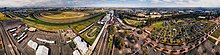
[5] The head of the Maribyrnong catchment is situated in the Macedon Ranges region of central Victoria around 60 kilometres (37 mi) northwest of Melbourne City Centre.
The Jackson Creek starts its journey northwest of Gisborne, 50 kilometres (31 mi) north of Melbourne CBD.
The other major tributary of the Maribyrnong is Deep Creek, which also has its headwaters in the northern and eastern parts of the Macedon Ranges.
The creek has cut a deep valley through the surrounding basalt plains in its southward course, in particular as it flows through localities such as Konagaderra and Bulla.
Brimbank Park forms a huge amphitheatre in the bend in the river with picnic areas, cycle and walking trails, and a café, that is usually busy on weekends and holidays.
At Avondale Heights and Essendon West residents have views over the river valley to the skyscrapers of the Melbourne CBD.
Today, swimming is not recommended due to exposure to untreated sewage in run-off from these heavily urbanised areas.
The first Europeans to explore along the river were the party led by Charles Grimes, Deputy Surveyor-General of New South Wales, in February 1803.
Light bushwalking can also be done and nature watchers can observe Australian native fauna such as echidna, wallabies as well as the ubiquitous possums and flying foxes.
Native birds include the eastern whipbird, cockatoo, rainbow lorikeet, galah, brown falcon, peregrine falcon, square-tailed kite, royal spoonbill, black swan, Pacific black duck, little pied cormorant, moorhen, and long-billed corella.
[16][17] Today, industrial pollution still occurs due to poor chemical handling practices, improper storage, and dilapidated infrastructure.