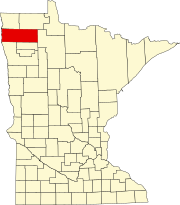
Marshall County, Minnesota
It was named for William Rainey Marshall, who served as Minnesota governor from 1866 to 1870.
Marshall County lies on Minnesota's border with North Dakota (across the Red River, which flows north along the county's western border).
The county terrain consists of low rolling hills, carved with drainages, completely devoted to agriculture where possible.
[5] The terrain slopes to the west and north, with its highest point near the midpoint of its eastern border, at 1,194 ft (364 m) ASL.
There were 4,791 housing units at an average density of 2.70 per square mile (1.04/km2).
28.70% of all households were made up of individuals, and 15.10% had someone living alone who was 65 years of age or older.